Hiking in Slovenia » Kamnik-Savinja Alps » Icmanikova Planina and Logarska Peč
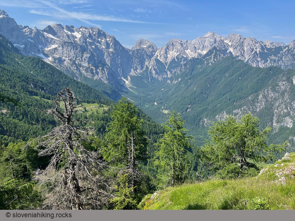
Icmanikova Planina (Icmanik Alp) is the highest-lying alp on the eastern slopes of Logarska Dolina (Logar Valley); the view from the nearby Logarska Peč is probably the best one in Logarska Dolina.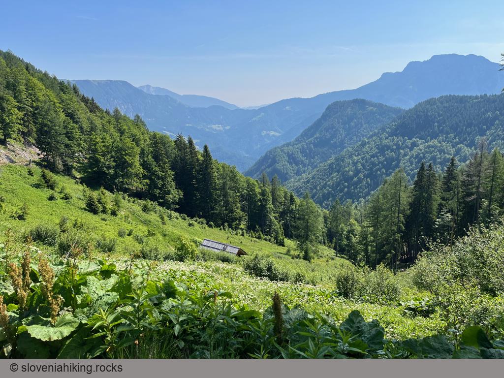
At a Glance
- Difficulty
- Steep hike on narrow footpaths followed by an easy stroll on a dirt road
- Altitude
- 1533 m
- Average time
-
Ascent: 2 hours 15 minutes
Descent: 1 hour 30 minutes
Total: 4 hours
- Elevation gain
- 780 m
- Coordinates
-
Start: 46.394621,14.630071
Peak: 46.400198,14.650746
Getting There
- Hike to Plesnikova Planina.
Next: You can reach Icmanikova Planina on an old neglected waymarked footpath, but I wouldn’t recommend it to anyone but seasoned mountaineers with a self-flagellating streak. Also, I couldn’t find the start of the path; recent treefalls and new logging roads significantly changed the landscape. Fortunately, you can follow a not-too-boring dirt road:
- From the huts on Plesnikova Planina, follow the signs for Strelovec.
- Stay on the broadest road going uphill and to the left.
- You’ll reach the saddle at the beginning of Icmanikova Planina in 45 to 60 minutes of easy walking through sparse forests.
Logarska Peč
You could follow the road and explore Icmanikova Planina; I decided to stop at the saddle and visit Logarska Peč – a vista point with a phenomenal view of the main ridge of Kamnik-Savinja Alps.
- The sign for the vista point (Razgledna točka) sends you onto a meadow. I couldn’t find a path crossing it, so I ascended in the approximate direction the arrow pointed to (right of the small hut) until I reached the first trees.
- A narrow footpath starts beyond the first trees somewhere on your left, runs parallel to the house for a bit, and then brings you to the vista point. Be careful; you’ll be standing pretty close to sheer cliffs.
Getting Lost on the Way Back
If you insist on testing the waymarked footpath, here’s how it worked out for me. Also, don’t even consider taking it in wet/muddy conditions. It’s a narrow footpath traversing steep, slippery slopes.
- I couldn’t find its start, so I descended an old dirt trail toward a small hut at the forest’s edge.
- There’s a red hiking sign just after the hut.
- The first part of the hike is not bad, although it’s pretty easy to miss the narrow footpath.
- You’ll end on a dirt trail after traversing a gully (surprisingly comfortably).
- The next section of the path is hard to find (I cheated and used a digital map with a GPS), but it’s also not worth following. Stay on the dirt trail; on every fork, keep going down and toward the left (south), and you’ll eventually end on the road from Logarska Dolina to Plesnikova Planina.
- Find the waymarked path and use it to return to Logarska Dolina.
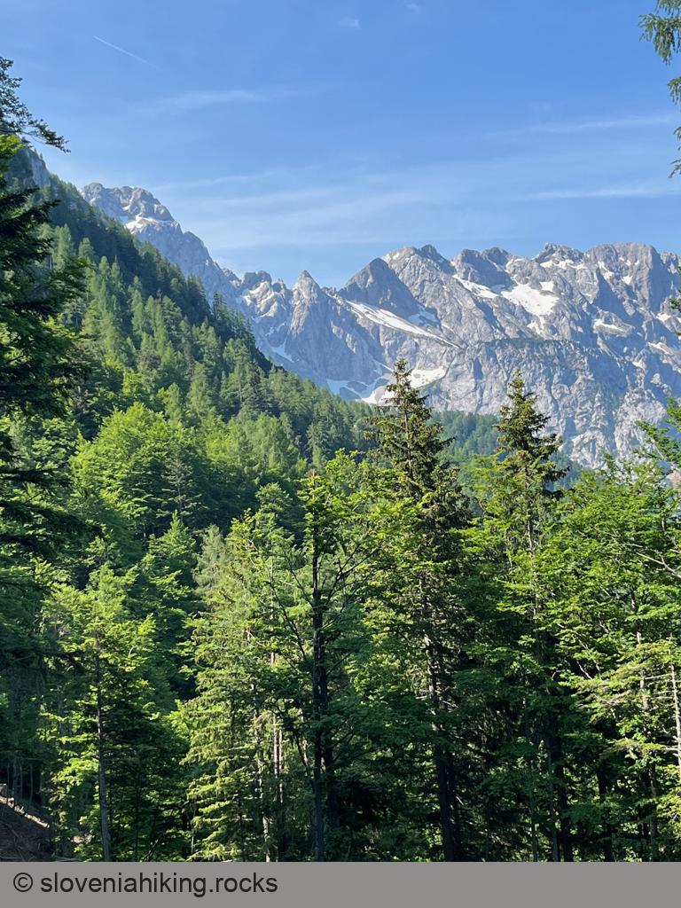
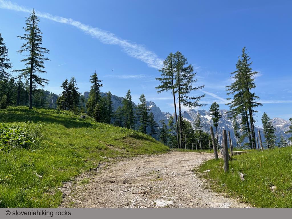
Photo Gallery
Map of the Route
The map shows the path we took as recorded by the GPS receiver. Never trust a GPS track wholeheartedly; rely on your senses and maps.