Regions » Kamnik-Savinja Alps
Notes
- Red dots on the map are hiking trips with English description;
- Green dots are biking tours.
- Gray dots are hikes without an English description. You might still want to look at the map, enjoy the photos, or use Google Translate on Slovenian text .
Hikes or biking tours with detailed descriptions
Biking to Saint Jacob above Preddvor (12 km, Δ=500 m)
When hiking to St. Jacob above Preddvor, you’ll cross a gravel road several times. You can use that road to get to the church (and enjoy a fantastic apple strudel in the nearby hut) on a bike.
Češka koča (Czech hut) (1542 m, Δ=560 m, 3 hours)
Češka koča (Czech hut) is probably the most popular destination in the mountains above Jezersko. At least four marked trails lead to it; we found the one via Štularjeva Planina (Štular’s Alp) by far the most pleasant.
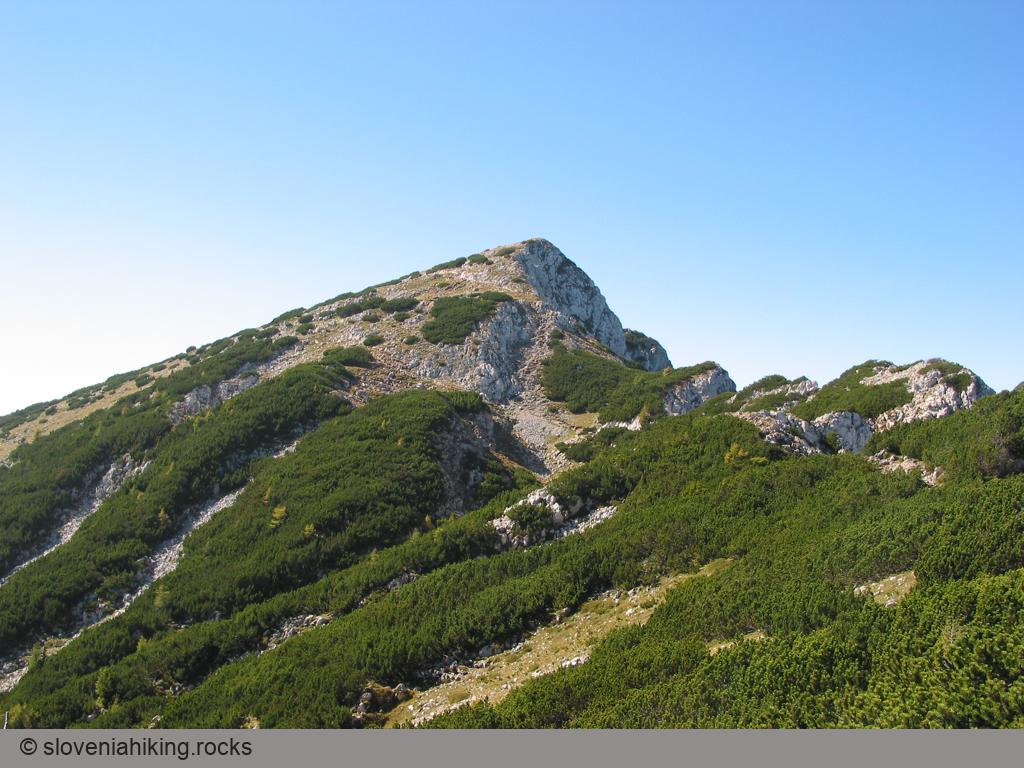
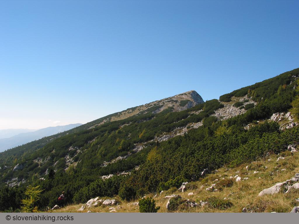
Goli vrh near Jezersko (1787 m, Δ=780 m, 4.5 hours)
Goli Vrh is one of the lower peaks in the Slovenia-Austria border ridge east of Jezersko border crossing. The path leading to the top is one of the steepest paths we’ve encountered in years, but the lovely views of Jezersko, surrounding mountains, Karavanke ranges, and Austrian peaks are well worth the effort.
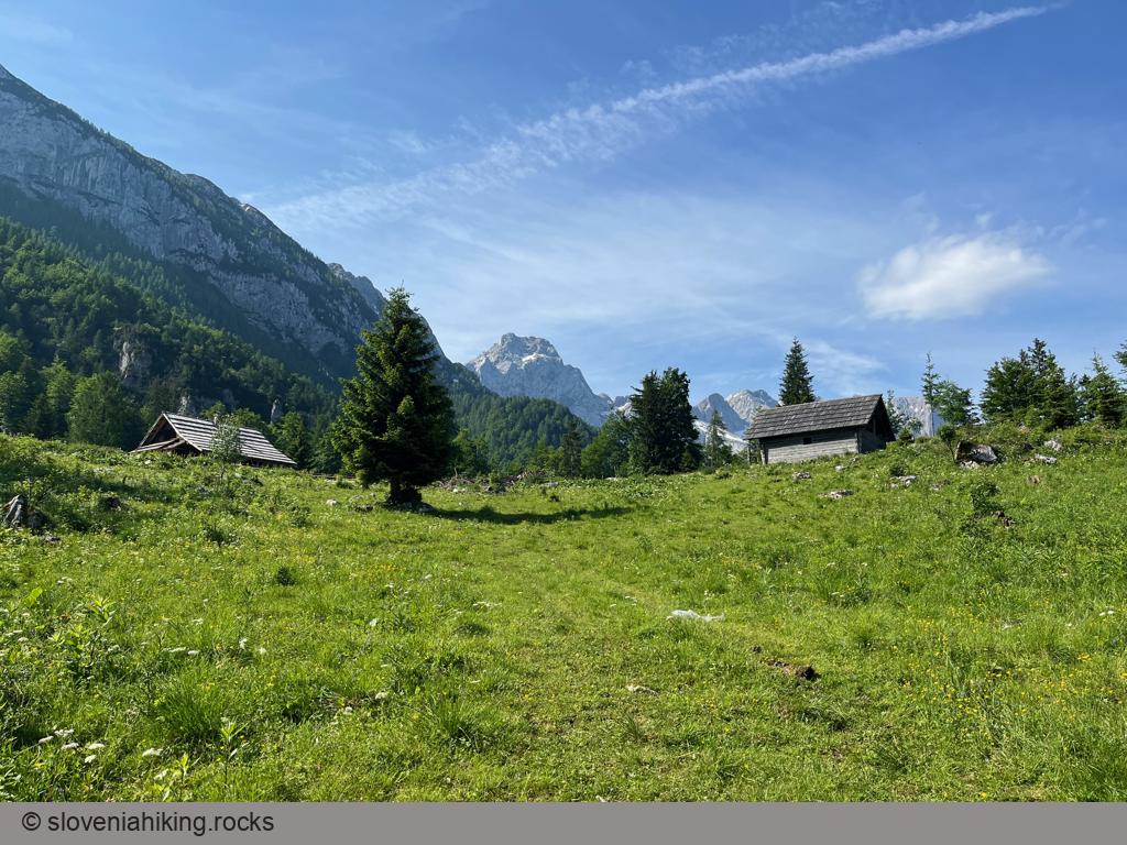
Icmanikova Planina and Logarska Peč (1533 m, Δ=780 m, 4 hours)
Icmanikova Planina (Icmanik Alp) is the highest-lying alp on the eastern slopes of Logarska Dolina (Logar Valley); the view from the nearby Logarska Peč is probably the best one in Logarska Dolina.

Jenkova Planina (1495 m, Δ=490 m, 3 hours)
Jenkova Planina is a small meadow on a saddle in a ridge running along the Slovenian-Austrian border with a nice view of the highest peaks around Jezersko. While the hike tends to be a bit boring, you’ll appreciate the dark forest you’re walking through in the summer heat.
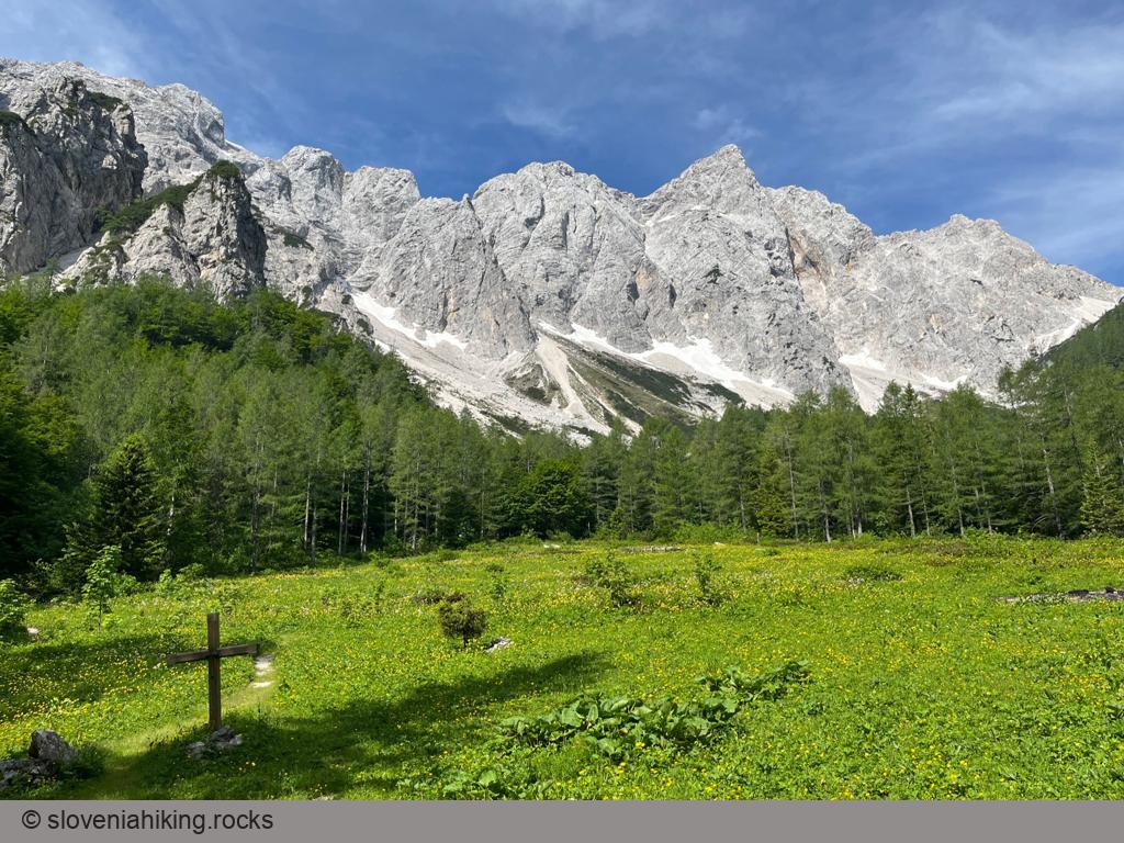
Okrešelj From Logarska Valley (1390 m, Δ=370 m, 2 hours)
Okrešelj is a phenomenal amphitheater at the end of Logarska Dolina (Logar Valley), surrounded by steep northern walls of the majestic peaks belonging to the main ridge of Kamnik-Savinja Alps.
Plesnikova Planina (1319 m, Δ=560 m, 3 hours)
Plesnikova Planina (Plesnik Alp) is a rarely-visited alp on the eastern slopes of Logarska Dolina (Logar Valley) with a lovely view of the surrounding mountains.
Raduha (2062 m)
On the highest peak of eastern Savinje Alps you’ll enjoy a fantastic panorama of the surrounding mountains and Logar valley, as well as an interesting view of Julian Alps and Karavanke ridge.
Raduha from Planina Loka (2062 m, Δ=630 m, 3.5 hours)
The simplest ascent of Raduha follows waymarked paths from the Planina Loka.
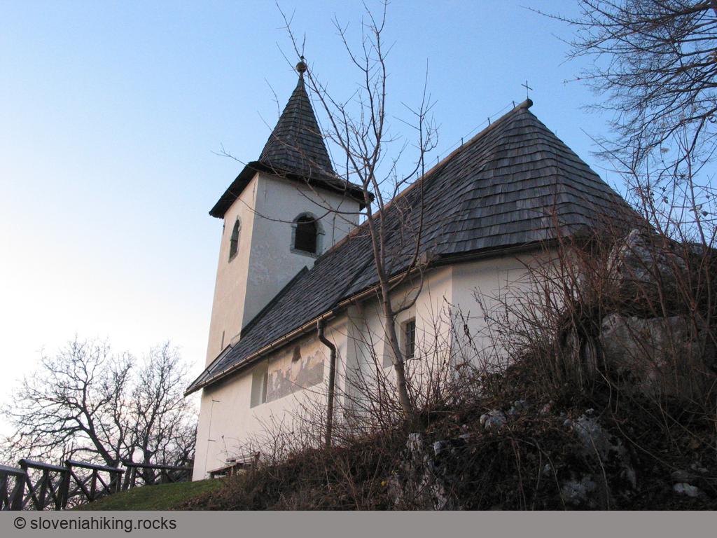
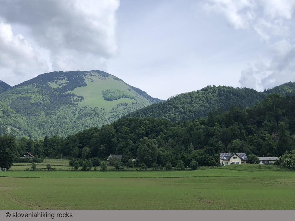
Saint Jakob above Preddvor (961 m, Δ=440 m, 2 hours)
From the church of Saint Jacob, sitting on the western ridge of Potoška Gora high above Preddvor, you’ll have a phenomenal view of the Slovenian Alps. The vista, and the legendary mountain hut next to the church, make this hilltop a beloved hiking destination.
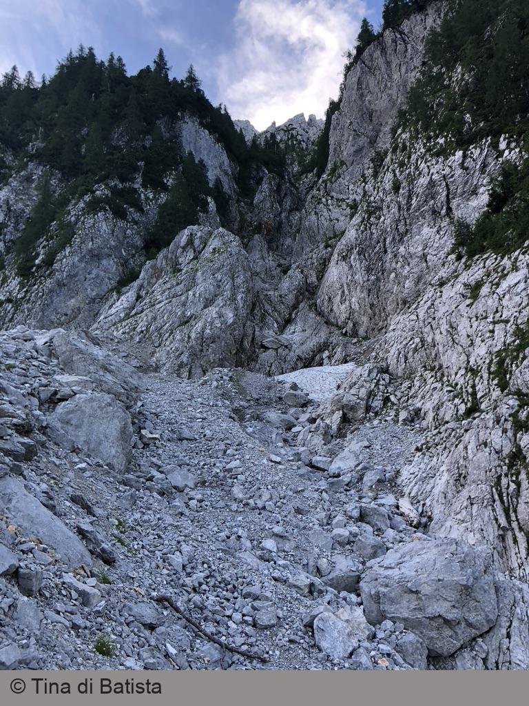
Storžič: Kramarjeva Grapa (2132 m, Δ=1020 m, 6 hours)
If you like easy long climbs and aren’t bothered by occasional loose gravel, you’ll love Kramarjeva Grapa (Kramar’s Gully) in Storžič’s north face. Apart from a few meters of a bit more demanding climbing, the difficulties usually don’t exceed being on a steep, somewhat irregular ladder. Kramar’s Gully is also excellent preparation for climbing the Slovenian route on Triglav’s North Face.
Strelovec (1763 m, Δ=1040 m, 6 hours)
Strelovec is a peak in the ridge east of Logarska Dolina (Logar Valley) with a magnificent 360-degree panorama of surrounding hills and mountains.
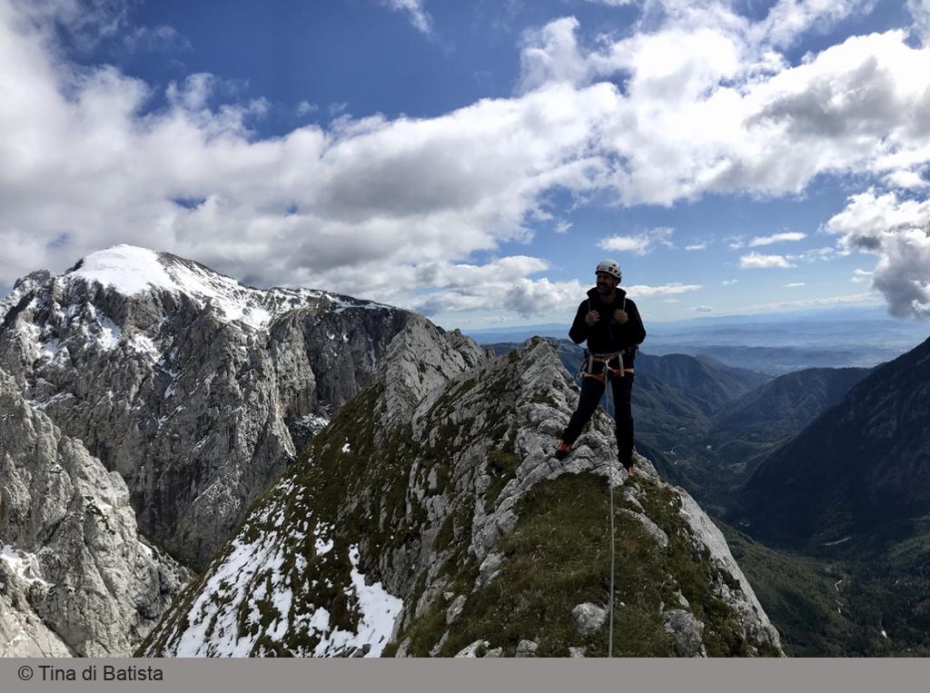
Veliki Greben (Big Ridge) (2006 m, Δ=1170 m, 6 hours)
Veliki Greben is a giant ridge in the heart of the Kamnik Alps. Even though it ends at a popular hiking trail traversing the southern slopes of Skuta (near the Instagram-famous bivouac), you are almost guaranteed to climb it in perfect solitude. Combine that with fantastic views from the exposed thin edge you’ll be climbing, and you’ll get an unforgettable experience.
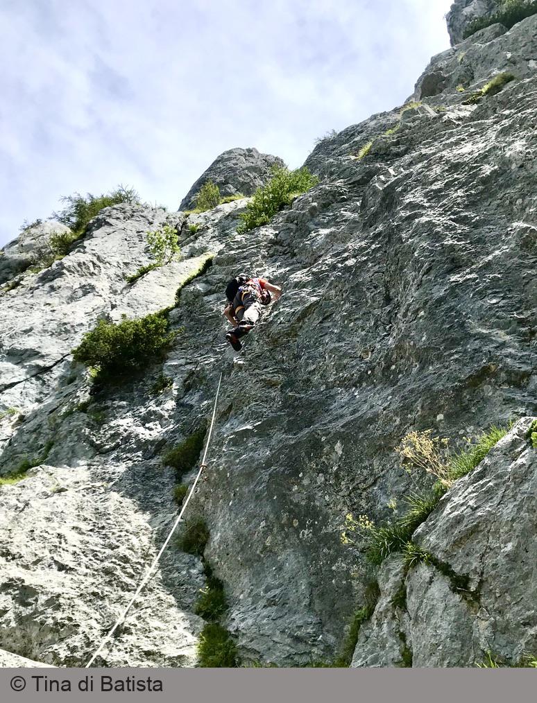
Veliki Vrh, Southwest Face (1300 m)
Veliki Vrh is a barely noticeable peak in a side ridge west of the prominent peaks of the Kamnik Alps. What sets it apart is a patch of monolithic rock in its southwest face with over a dozen well-protected bolted multi-pitch routes – the ideal destination for a leisurely day on the rocks or the first steps into the exciting world of multi-pitch climbing.
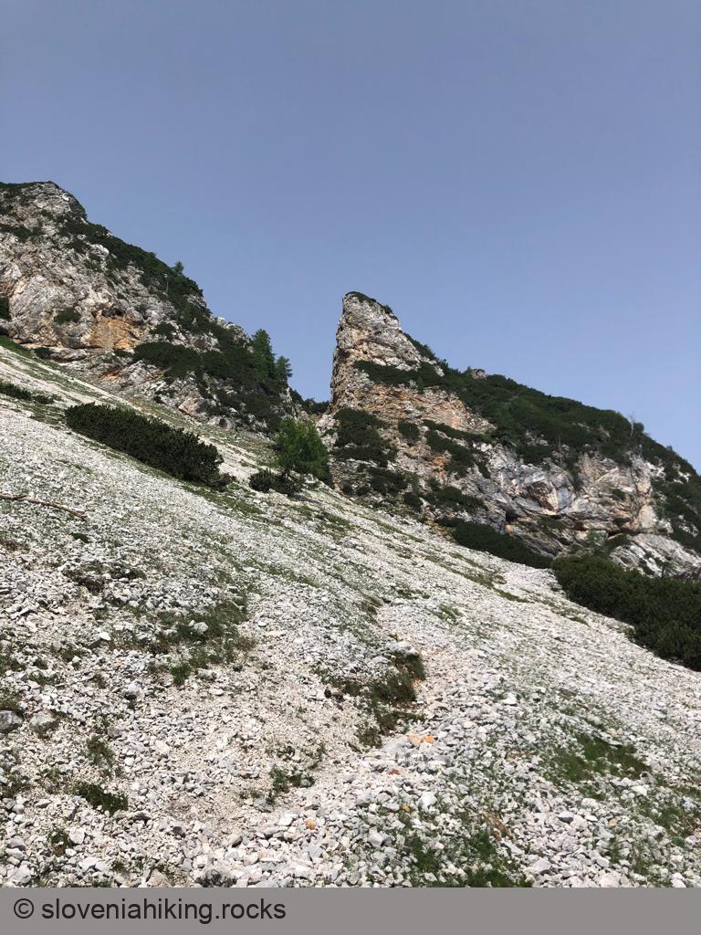
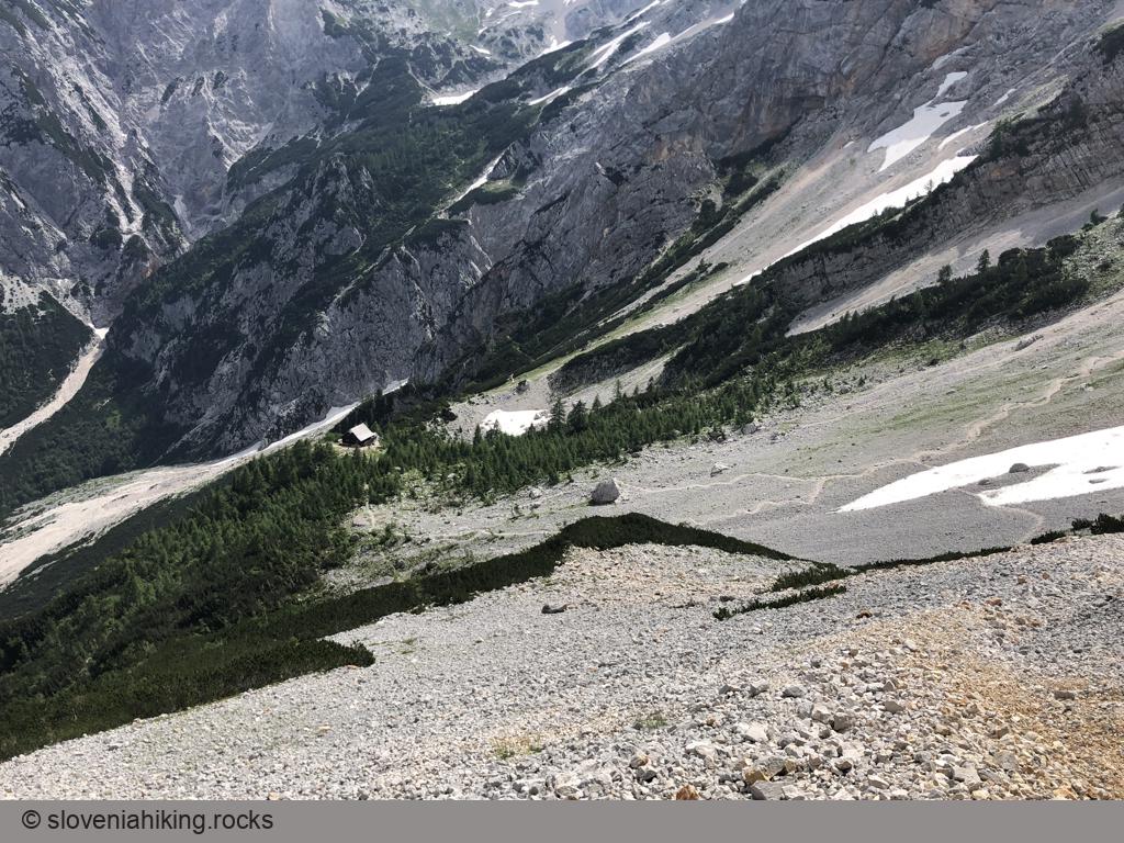
Vratca above Češka koča (1802 m, Δ=800 m, 4.5 hours)
Vratca (Doors) is a prominent rock pillar above Češka koča (Czech Hut) with a great view of the surrounding mountains. The last bit of the trail is well-protected Via Ferrata through a crumbling gully – a helmet is highly recommended.
Other hikes in this region
- Ambrož near Krvavec (1088 m, Δ=490 m, 3 hours)
- Baba (1119 m, Δ=620 m, 2.5 hours)
- Goli vrh on Šavnice (1426 m, Δ=1020 m, 4.5 hours)
- Grintovec (2558 m, Δ=1700 m, 9 hours)
- Hiking around Velika planina (1666 m, Δ=350 m, 3 hours)
- Kalški greben (2224 m, Δ=1150 m, 7 hours)
- Kamniški vrh (1259 m, Δ=770 m, 4 hours)
- Kamniško sedlo (1876 m, Δ=1280 m, 6 hours)
- Klemenča jama (1208 m, Δ=440 m, 3 hours)
- Konj (1803 m, Δ=1200 m, 6 hours)
- Kranjska reber (1435 m, Δ=540 m, 3.5 hours)
- Krvavec and Zvoh (1971 m, Δ=530 m, 2.5 hours)
- Raduha from Robanov Kot (2062 m, Δ=1480 m, 8 hours)
- Saint Jost from Lipa (935 m, Δ=210 m, 1 hour)
- Saint Jost from Vransko (935 m, Δ=630 m, 4 hours)
- Saint Primož above Kamnik (826 m, Δ=400 m, 2 hours)
- Velika planina from Volovljek (1666 m, Δ=640 m, 4 hours)
- Veliki Rogatec from Gornji Grad (1577 m, Δ=1000 m, 6 hours)
- Vransko - Čreta (944 m, Δ=600 m, 4 hours)
- Vrh Korena (1999 m, Δ=500 m, 5 hours)