Hiking in Slovenia » Julian Alps » Viševnik
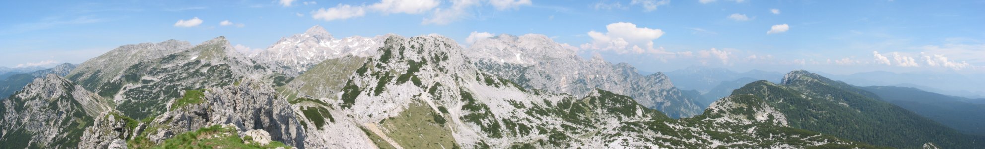
Viševnik is one of the highest summits in the ridge separating the Pokljuka plateau from the Krma valley. After a steep ascent, a marvellous view awaits you on the top, embracing the peaks around Triglav, Pokljuka itself and the Bohinj mountains. Those with somewhat better condition can continue from Viševnik through a real high-altitude landscape towards the mountain huts Blejska koča or Vodnikov dom.
At a glance
- Difficulty
- A steep waymarked route
- Access
- The ascent is made from Rudno polje on the Pokljuka plateau
- Distance
- **Individual sections:
**Rudno polje – Viševnik: 2 hours
Return to Rudno polje: 1 hour 30 minutes
Viševnik – Blejska koča on Lipanca: 2 hours
Lipanca – Rudno polje: 1 hour 15 minutes - Altitude
- 2050 m
- Height difference
- 700 m
- Season
- The ascent of Viševnik is finest in late spring, when globe flowers, spring gentians, alpine clematis, alpine anemones and mountain avens are blooming on the slopes above the ski grounds. The entire route follows open sunny slopes, so an ascent on hot summer days is not advisable.
- Recommended equipment
- The path is steep, so good boots and trekking sticks are advisable.
- Map
- Julian Alps, vzhodni del (eastern part) 1:50 000 PZS
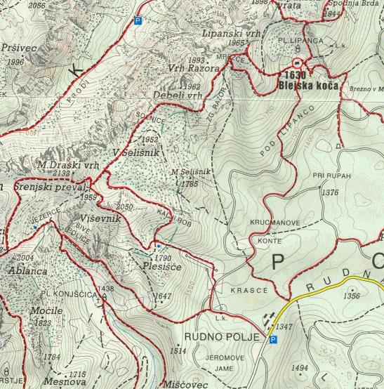
The ascent from Rudno polje
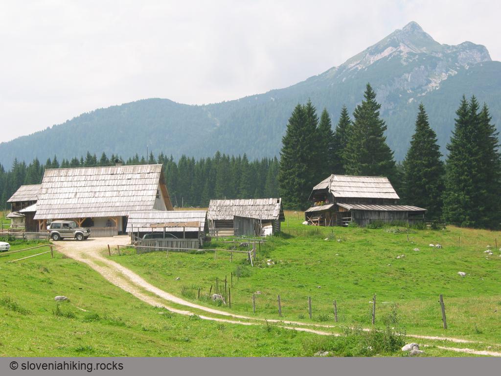
You begin the ascent of Viševnik from Rudno polje, one of the westernmost alps on the Pokljuka plateau, which is reached by an asphalt road from Mrzli studenec across Pokljuka. Back in the times of the Austro-Hungarian Monarchy a military barracks was erected on Rudno polje; opposite this is a carpark, which you can use. There are no signposts for Viševnik here, only one directing you to Triglav. Since we know Viševnik is nearer Triglav than Pokljuka is, it is sensible to follow this and take the forest road past the military barracks to the ski grounds on Pokljuka.
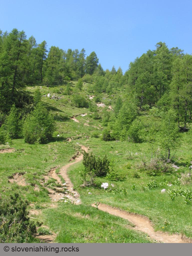
The forest road leads you to the right past the ski slope as far as the junction where the road towards Vodnikov dom (and Triglav) branches off to the left, but you continue towards the right, back onto the ski slope, which you cross. At the end of the grassy slope the macadam road turns back into the forest, but a signpost for Viševnik will direct you left, onto a narrow cart-track, which climbs steeply up the ski slope right beneath the ski lift.
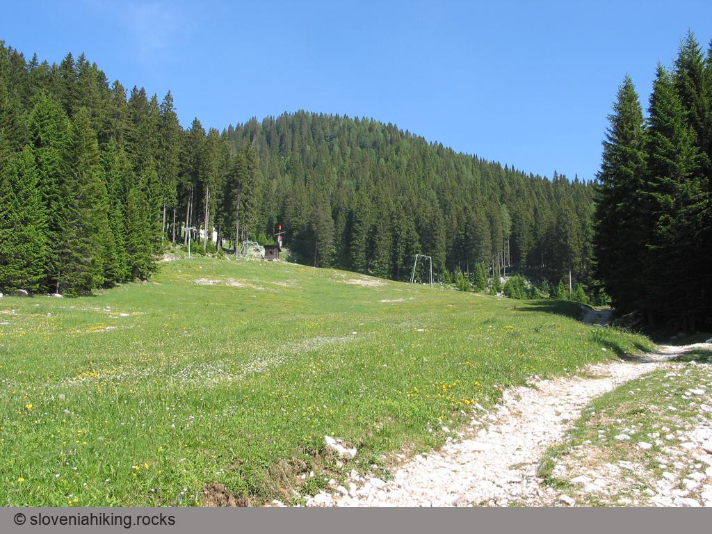
After the first few metres of this ascent, it will be clear what lies ahead – the path rises with merciless steepness up the ski slope, while the sun »warms« your back all the time. But every disadvantage also has positive aspects – you gain height quite quickly and soon you'll be able to enjoy the view of the Pokljuka forests far below you while taking short rests.
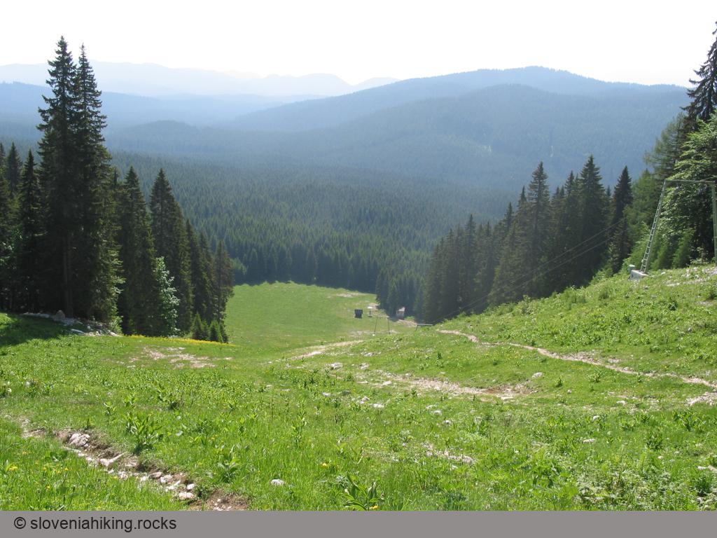
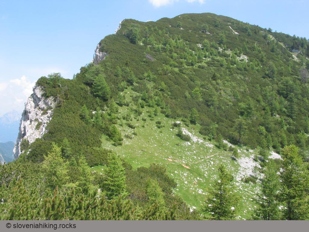
High above you'll also notice the first summit on your route – but don't rejoice too soon, Viševnik is still hidden, and Plesišče, which you're looking at, is a good 250 metres lower.
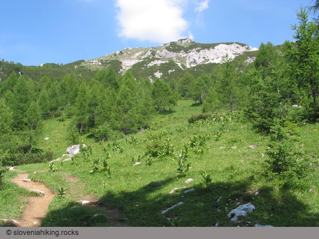
At the top of the ski slope the cart-track, which is probably used for access to the last ski lift, changes into a footpath which reckons with the limitations of our legs and not only the capacities of four-wheel-drive vehicles – all of a sudden the route which previously went straight uphill begins to rise in serpentine bends, which makes the ascent much pleasanter. In the spring months a veritable exhibition of spring flowers also awaits you on the damp steep meadows above the ski slope – the white blossoms of alpine anemones, golden-yellow globe flowers, light-blue Julian flax and the violet flowers of alpine clematis.
A bare 20 minutes' climb across these meadows brings you to a small alp below the summit of Plesišče. You have now gained a good 350 metres from the starting-point, which means that you're just half-way through – a more than good enough reason for taking a short break.
Toward the peak
Now you can continue your way towards Viševnik. The path first crosses the alp and then divides – to the right is a path avoiding the summit of Viševnik, leading across Kačji rob towards the mountain hut Blejska koča, while the path straight ahead over the grassy slope leads to the summit; this begins to climb steeply again towards the ridge between Plesišče and Viševnik. On these grassy slopes you will notice the first spring gentians, oxlips and alpine butterwort.
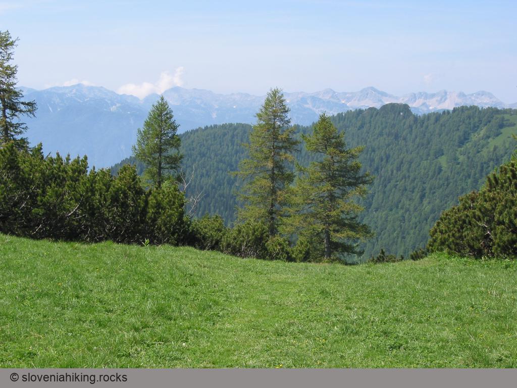
A short ascent brings you to a small saddle in the ridge from where the view to the west first opens up – below you lies the Konjščica alp, with Uskovnica behind it, while in the background are the mountain tops around Lake Bohinj.
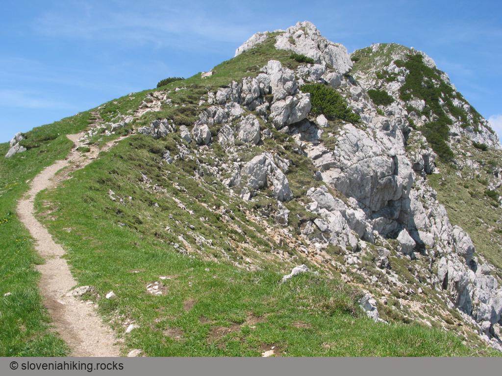
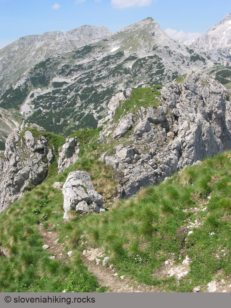
The vegetation around shows that you've come above the tree-line, for only dwarf pine grows here, but not so densely that it would seriously hinder your progress. Above you the goal of your trip is now visible – the rocky summit of Viševnik, which can be reached after about 45 minutes' ascent.
The slope you're following first rises quite gently but the path soon becomes steep again, and leads you onto the east ridge of Viševnik, where a few minutes' walk along the rocky path brings you to the summit itself.
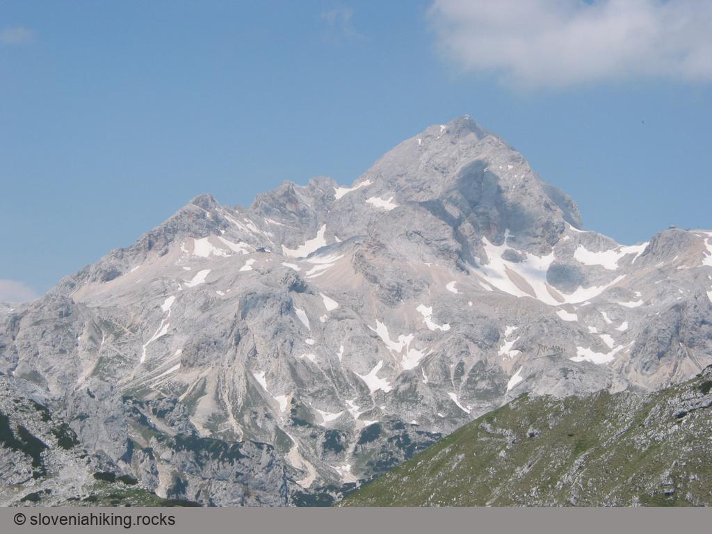
Throughout the climb to Viševnik you can enjoy views of Pokljuka and as soon as you're above Plesišče you notice the Bohinj mountains, while from the top of Viševnik there is a vista of Triglav and his neighbours, and you can also see part of Lake Bohinj – in fine weather the view is superb.
After a short rest you can return by the same route to your starting-point or continue the trip to the mountain hut Blejska koča on Lipanca, from where you return to Rudno polje.
Another suggestion for a considerably shorter round tour – drop down from Viševnik over the saddle Srenjski preval towards the Lipanca alp but then turn right onto the path which climbs from Pokljuka over Kačji rob to Lipanca, and return by this route to Rudno polje.
From Viševnik to Lipanca
The path to Lipanca leads over the summit of Viševnik along the rocky ridge where you descend above the mountain's steep western slopes towards Srenjski preval. On the saddle the path divides – straight ahead the path leads below Draški vrh over another saddle, Studorski preval, to the mountain hut Vodnikov dom, while the path towards Lipanca drops to the right into the basin below Viševnik. There are only a few waymarks at the fork but some metres lower down you find the first waymark beside the path, so you can't get lost – the continuation of the path across the basin is very clearly visible.
In mid-June you'll still find in this basin remnants of snow which you must tramp through as you ascend out of the basin. But not to worry, the snow is your friend this time – while it is melting, soldanella will probably be in flower. On the edge of the basin the path leading to Blejska koča over Kačji rob joins your route from the right. You can use this way for a shorter round tour back to Rudno polje, but we'll continue along the varied path that runs first under the steep, rocky northern slopes of Selišnik and then over pine-grown slopes towards Debeli vrh.
The path avoids Debeli vrh along its eastern side and slowly begins to descend, as you notice also with the density of dwarf pine, which in places quite unpleasantly grows over the path. Past Debeli vrh you come under Vrh Razora, from where you can see the route on the neighbouring slope as it winds above the valley of Zgornji Razor and by which you descend to Blejska koča.
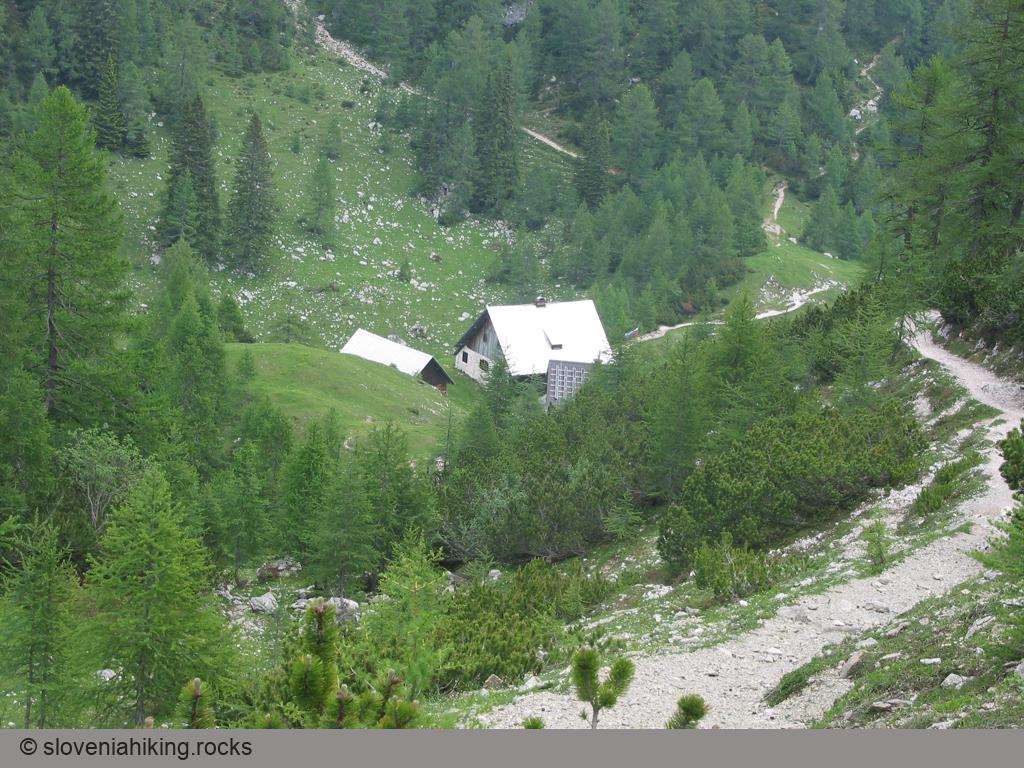
Prior to the descent the path forks once more – the left one leads up to Mrežce and Lipanski vrh while you drop gently down to Blejska koča. You soon cross the tree-line again, the dwarf pine is replaced by sparse spruce forest and the walk becomes much more pleasant. After 20 minutes' descent the path from Mrežce joins in again from the left and only a few hundred metres remain to the mountain hut Blejska koča on Lipanca.
Map of the Route
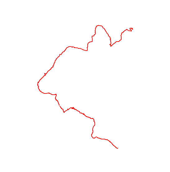
The map shows the path we took as recorded by the GPS receiver. Never trust a GPS track wholeheartedly; rely on your senses and maps.