Hiking in Slovenia » Kamnik-Savinja Alps » Raduha » Raduha from Planina Loka
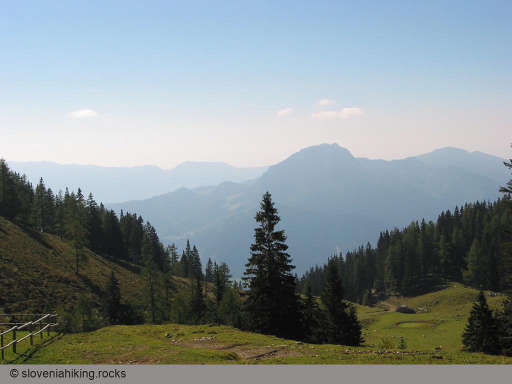
The simplest ascent of Raduha follows waymarked paths from the Planina Loka. You can drive quite high up along well-maintained forest roads, almost as far as the mountain hut on Loka, so instead of walking up through the beech forests, you can enjoy starting the trip through sparse conifer forest and over high-altitude meadows. The trip can be extended by descending to Planina Arta and returning by a little-frequented path through dark spruce forest to Planina Loka.
At a glance
- Difficulty
- In places a sparsely waymarked route, but not too steep.
- Access
- The circular route across the southern slopes of Raduha begins from the mountain hut on Loka, which is reached by a forest road.
- Distance
- Mountain hut on planina Loka– summit of Raduha: 1 hour, 30 minutes
Summit of Raduha – planina Arta: 1 hour
planina Arta – mountain hut on Loka: 30 minutes
Total: 3.5 – 4 hours - Altitude
- 2062 m
- Height difference
- 630 m
- Season
- The route mostly runs along open, sunny slopes, so don't visit Raduha in the worst summer heat. The trip will be most beautiful in late spring (May, June), when you can enjoy the abundance of meadow flowers.
- Recommended equipment
- The path is occasionally steep (trekking sticks will be useful, especially during the descent) and pretty rocky in the upper part. Although you'll meet brave »mountaineers« along the way with an unusual choice of footwear, I'd recommend mountain boots in any case.
- Map
- Kamniške in Savinjske Alpe, mountaineering map 1:50.000
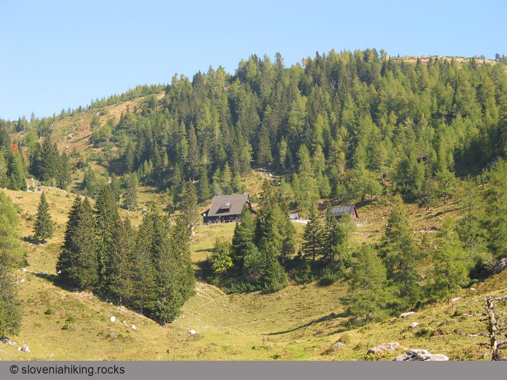
Planina Loka
This ascent of Raduha (or if we're more precise, of Velika Raduha, since to the east is Mala Raduha, 30 metres lower) starts below planina Loka, where a mountain hut is situated. A forest road from Struga, a hamlet in the Upper Savinja Valley, will bring you to the alp.
You reach Struga most easily along the road leading from the Šentrupert exit on the Ljubljana – Maribor motorway towards the Logarska dolina valley. Those who come from western Slovenia and prefer to drive along narrow, but more picturesque roads can opt to travel via Gornji Grad (or along the still more adventurous macadam road over Kranjski Rak). In either case, some kilometres before reaching the village of Luče, you'll notice a signpost in Struga pointing towards Snežna jama (Snow Cave) under Raduha. Follow the signpost along a narrow asphalt road, which at first runs by the Dupljenik stream and then forks after the first uphill climb.
Here turn off right (direction Raduha / Snežna jama) onto a forest road that brings you after 11 kilometres to the parking area below planina Loka. From this parking area to the hut on Loka you have about 15 minutes' ascent along a pleasant cart-track between sunny meadows on the alp.
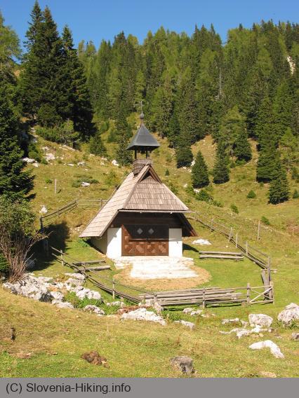
In front of the hut on Loka signposts orientate you in three directions – waymarked paths lead towards Snežna jama, the summit of Raduha and the Durce saddle. The direct path to Raduha is naturally the shortest (so you'll meet most people here) but also the least picturesque … as in many other places in the Slovene mountains the majority of mountaineers in their charge for the summit therefore miss the beauty around them. Interestingly, the popularity of the route is reflected by the waymarks – those on the direct path to the summit are fresh and shining, while on the path to Durce you can hardly see some faded, reddish little circle. But not to worry – in snowless conditions the path is clearly visible, while crucial places are also well indicated.
Via Durce to Raduha
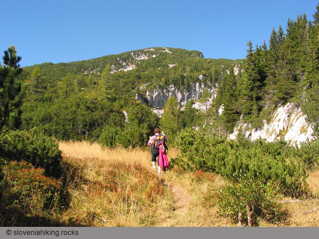
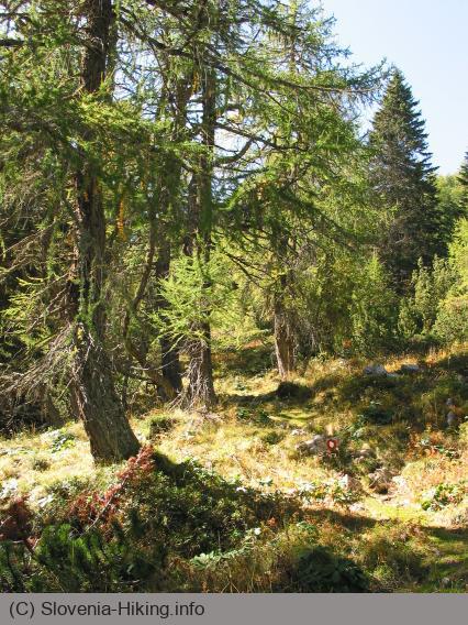
The Durce route at first follows the direct path to the summit of Raduha, which begins behind the mountain hut, but soon branches off from it, turning right across the meadow towards the forest margin in the eastern part of the alp. Already here on the alp you encounter the first steep ascent over meadows, and then the route switches back to the left, into sparse larch forest where the gradient is easier and the little path pleasantly varied.
Some minutes later you again find yourself in a meadow, in front of you appears the first view of Mala Raduha's summit, below which gleam steep limestone crags. The path takes you across the rocky meadow almost under the crags, but then avoids them up the scree on their right.
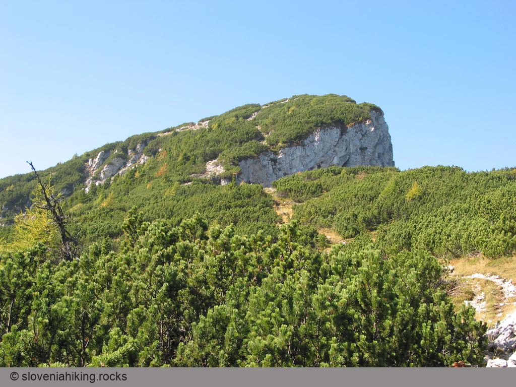
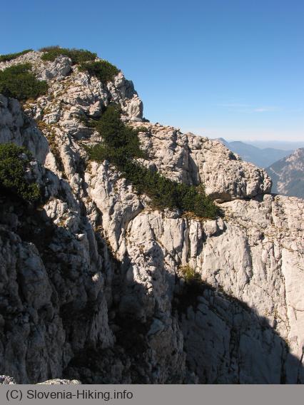
In the middle of the scree the path again turns left and leads you in a stiff climb above the crags that had blocked your way. Where this ascent ends on gentle meadows under Durce it's worth taking a good look around you – you've already come so high that you see the mountains below Raduha, while to the southeast you'll pick out Smrekovec and the summits above the town of Mozirje. A short walk over the meadows brings you to the Durce saddle, from where you have the first view of Peca as well as of the precipitous rock faces that drop towards the planina Grohot alp far below. You might also expect to see Olševa to the north, but at this spot it's still partly hidden by the slopes of Raduha.
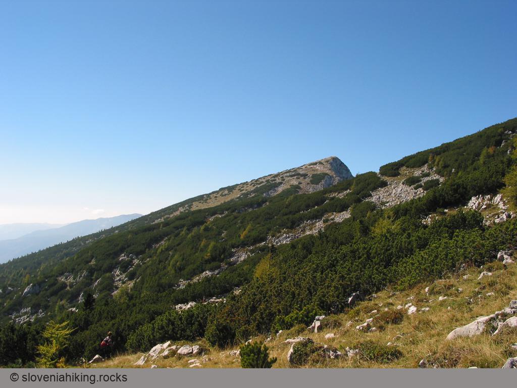
From the Durce saddle a narrow little path climbs right above the sheer faces (from a distance this ascent looks really terrifying, because it looks as if you must climb immediately above the abyss, but in fact the path is always at least several safe metres away from the dangerous edge), and then you begin to follow the slope of Mala Raduha along a gentle, yet fairly rocky route. Soon after the summit of Mala Raduha is left behind, the path starts to descend, leading you to the junction with the direct route to Velika Raduha; now there's only a saddle and the final gradient before you reach the summit itself.
Those who wish to bag two two-thousanders within one hour can head off up to the right just before the beginning of the descent mentioned – with a bit of skill you'll succeed in finding one of the paths that guides you through the dwarf pine cloaking the grassy slope to the top of Mala Raduha.
Velika Raduha
From the junction with the path to Velika Raduha from planina Loka continue dropping gently down to the saddle between the two summits. On the far side of the saddle, just before the last ascent begins, a climbing route from planina Grohot also joins the path; seen from the top, this looks at least in its upper part considerably more airy and dangerous than the one from planina Grohot to Durce.
The most ardent mountaineers can carry on from this point steeply straight up to the top, more moderate ones will probably prefer the somewhat easier route that turns slightly left and then rises over gentle grassy slopes to the summit.
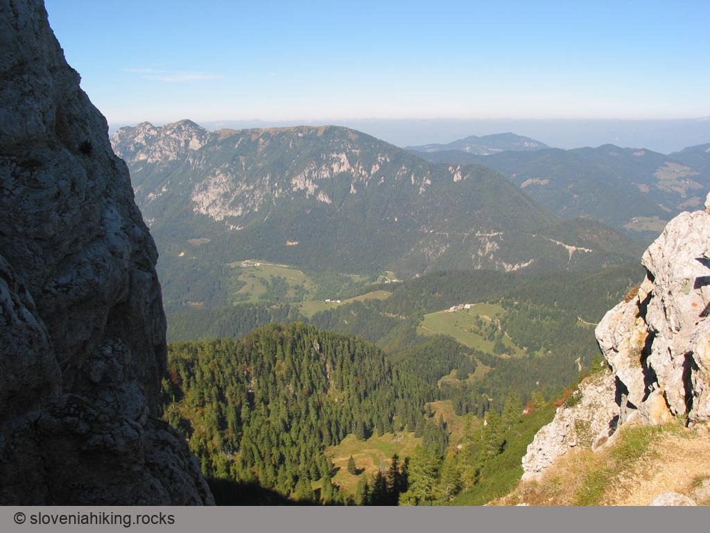
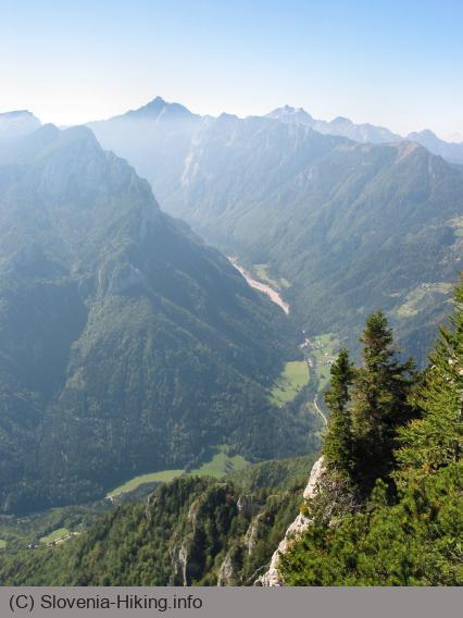
Just as you might expect, a phenomenal panorama greets you on top of Raduha in fine weather. Northwards your gaze first rests on the slopes of slightly lower Olševa, to its right rises Peca, while beyond Olševa on a really clear day you'll be able to pick out three-thousanders in the Austrian Alps – those who know them well will probably also recognize Grossglockner among them.
The view eastwards presents the somewhat lower summits between the Savinja Alps and the Pohorje range - Uršlja gora, Smrekovec and Boskovec, and Medvedjak above Mozirje – but certainly the most interesting view is westwards – right in front of you Ojstrica reigns, left of that you'll see Konj above Velika planina, while to the right are the other peaks of the Savinja Alps. Then right of these a real treat awaits you – the ridges of the Julian Alps and the Karavanke almost overlap, in such a way that immediately in front of Triglav you'll see the long ridge of Košuta.
After a short rest on top of Raduha you can return to the mountain hut by the direct route, but a round tour via planina Arta is much more interesting.
Return via planina Arta
The path towards planina Arta and Snežna jama at first drops westwards over grassy slopes below the summit of Raduha, but soon turns in among the dwarf pine and once again becomes quite rocky. At the beginning the gradient is very gentle until you reach the west faces of Raduha, where the path turns left and starts to drop steeply – at first over meadows, then through a cut in the dwarf pine, which fortunately soon gives way to sparse larch forest.
In the larch forest the path several times approaches the precipitous west faces for just a few metres, which allows you to see the Robanov kot valley and the Upper Savinja Valley far below you. But do be careful – at one viewpoint where I enjoyed looking down into the valley, the dwarf pine grew far over the vertical edge, which could quickly carry a bold, imprudent admirer over the edge.
After approximately 40 minutes' steep descent, the route again turns somewhat to the left, towards planina Arta, which is reached by a pleasantly varied little path through airy larch forest. You can stop and rest a little on the alp and then continue towards the mountain hut on Loka or else descend towards Snežna jama.
The route for the mountain hut on Loka turns below the herdsman's dwelling on planina Arta left along a narrow, scarcely visible little path over the meadows. At the edge of the forest it partly widens, leading you between the steep meadows above and the spruce forest below to the gate marking the end of the alp.
If you have difficulty searching for the path over the meadows, make directly for a fallen spruce which you'll notice east of your position even by the herdsman's dwelling. Judging by its state, this spruce has been lying over the path for quite some time, so there's not much danger that this »signpost« would be moved in the near future.
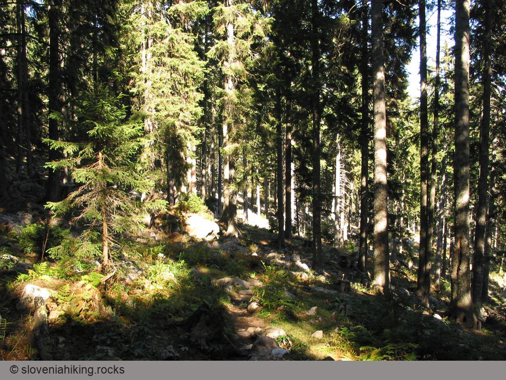
Beyond the gate a real spruce forest begins, which as a practical example demonstrates that the Grimm brothers fairytale about Hansel and Gretel isn't entirely imaginary – even after a few hundred metres you could be utterly lost in this forest.
If you're a bit inattentive at the beginning, you'll soon turn too much to the right along an apparently quite well-used little path and so miss the waymarked route, which turns slightly left up the slope. But also further on it's better to watch out for the waymarks – the rocks that literally cover the ground among the trees together with the carpet of spruce needles successfully hide all traces of your predecessors, so you can rely only on the waymarks to find your way. If successful, in about 30 minutes you'll find yourself by the chapel on planina Loka, otherwise a little fairytale cottage of sweets and chocolate is probably waiting somewhere for you.
Map of the Route


The map shows the path we took as recorded by the GPS receiver. Never trust a GPS track wholeheartedly; rely on your senses and maps.