Hiking in Slovenia » Julian Alps » Vogel
Vogel is certainly the best known summit of the Lower Bohinj Mountains, but not because of its view (which is similar to the view from the other summits along the same ridge) or its fine pyramidal shape, but because of the ski centre, to which it has lent its name.
The ski centre (or more precisely the cable car from Lake Bohinj) is also to blame for the summer crowds, as the waymarked path from the upper cable car station to Šija and Vogel becomes a real pilgrimage route. In order to avoid the summer crowds or to enjoy the autumn sunshine, we'll ascend Vogel across its south-western slope from the Razor alp.
At a glance
- Difficulty
- An excellently waymarked occasionally steep path.
- Access
- The ascent begins from the Razor alp, which is reached by paths from Tolminske Ravne or from the alps Lom and Kuk.
- Distance
- Planina Razor – Vogel: 2 hours
Return: 1 hour 30 minutes
Total: 4 hours - Altitude
- 1922 m
- Height difference
- Planina Razor – Vogel: 610 m
Add ~400 m when starting from Tolminske Ravne - Season
- I would advise against doing this ascent in the summer heat as the path is very open and sunny. It is finest in late spring (flowers) or early autumn.
- Recommended equipment
- Please do yourself a favor and don’t go in your basketball footwear. Rugged mountain boots are mandatory if you decide to return via the Globoko saddle, or explore pathless terrain.
- Map
- Julian Alps, vzhodni del (eastern part), 1:50 000
Via Krnica to Vogel
The waymarked route to Vogel begins at the fork in the path immediately behind the mountain hut on the alp planina Razor, where the lefthand branch leads towards Krn, traversing the alp planina na Kalu, while somewhat more to the right, up over the alp, the other path leads towards Škrbina, the Globoko pass and Vogel. After five minutes' walk over the meadow you turn right at the next fork into a small, sparse beech forest, which also offers you the only shade on the entire route.
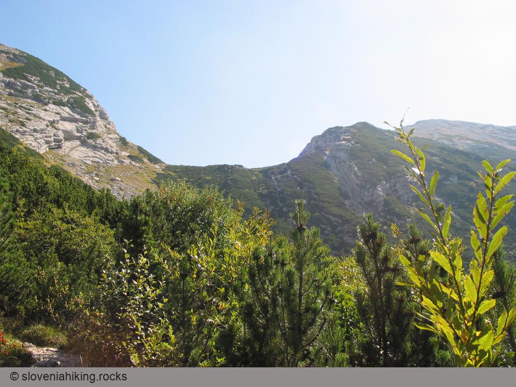
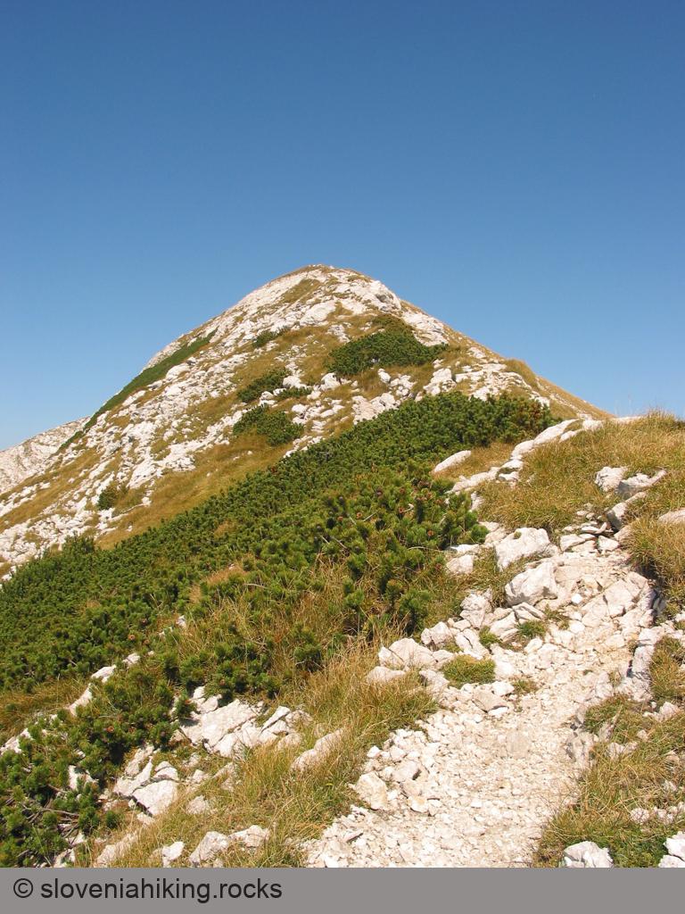
Beyond this little forest a rather steeper ascent begins, which brings you to the next fork – the path to Vogel bears right, while through the dwarf pine you can see the pass high above you which you have to cross. The narrow path through the dwarf pine is fairly gentle at first but starts to climb more steeply before the pass and after a good half-hour's ascent leads to a smaller saddle before Krnica, from where the first view of the summit of Vogel opens up.
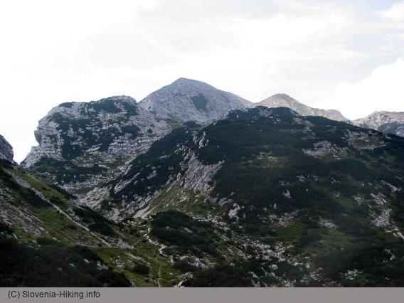
At this point you've completed more than half the climb, so it will probably be quite appropriate to treat yourself to a short rest, during which you can enjoy the marvellous view of planina Razor, the Tolmin hills in the background, the slopes of Žabiški Kuk on your left and the steep faces of Vrh Krnic to your right. Those endowed with more of an explorer's spirit will probably go off to inspect the bunker hidden in dwarf pine just a few metres from the path.
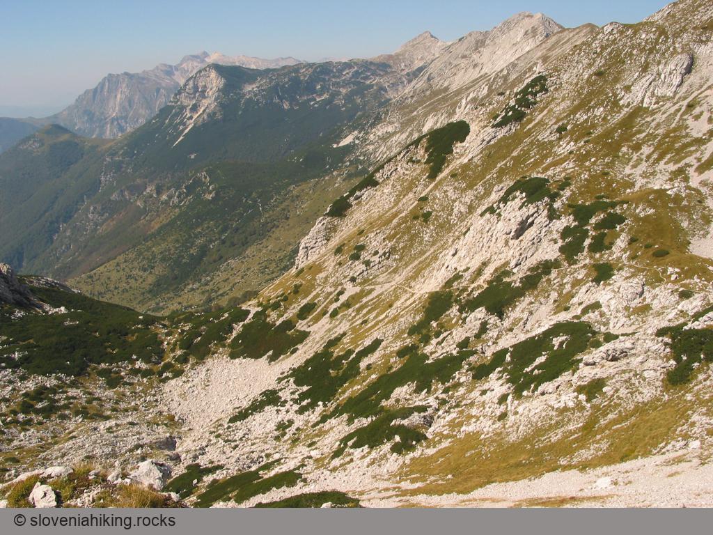
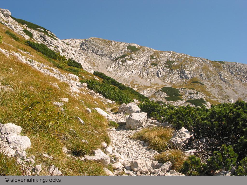
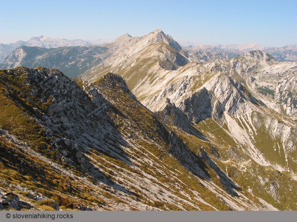
Above the pass the path again becomes gentler and turns first over the grassy slope and then across the screes under Vogel and finally after a short ascent brings you over rocky crags to the ridge between Vogel and Žabiški Kuk. Here the view to the east first opens up along the ridge of the Lower Bohinj Mountains and the hills beneath you while in the background you can also sense the outlines of Kojca and Porezen. On the ridge the path forks – to the right you can walk to the summit of Žabiški Kuk, and to the left you traverse along the grassy ridge up to the top of Vogel, where a marvellous view awaits you of Triglav and the Julian Alps.
Return
You can return from the top of Vogel to planina Razor by the same route (if you're tired, you'd better choose this option), or you can make a short circular tour over the Globoko pass. The path to this pass drops from the summit along the western ridge (follow the Črna prst direction) and at the first saddle between Vogel and Vrh Krnic leaves the ridge and descends about 100 metres lower onto the Bohinj side.
If you're not an experienced mountaineer or if the weather is a bit doubtful, I'd advise you to keep to the waymarked path, which after a short descent will lead you below the slopes of Vrh Krnic to the Globoko pass, where you turn left (back towards the Razor alp). Somewhat more crazy mountaineers can decide on a much more interesting and very panoramic route, which leads along the ridge almost as far as the Globoko pass. On the first saddle between Vogel and Vrh Krnic continue walking along a clearly visible little path which first climbs to Vrh Krnic and then begins gradually to descend. Beyond the next summit there's a few metres of easy rock climbing, then the path passes over to the Primorska side, bringing you by a steep descent to the next saddle.
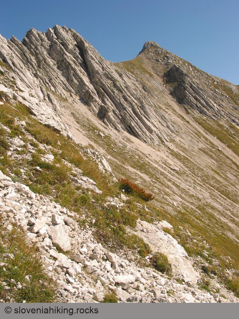
Here a fresh test of »craziness« awaits you – you can continue walking straight on along the ridge (though before the Globoko pass there's some unpleasant climbing along the shattered ridge), but it's much better to drop over the scree on the Primorska side below steep rocky crags and then continue traversing just under them. The very steep descent down the scree is quite entertaining at the beginning as kilograms of stones roll under your feet, and then you gradually come to firmer ground, where you can cross the scree and come below the rocks to a narrow, scarcely visible little path (though in good weather it can be seen from the ridge).

Along this little path (the warden of the mountain hut on Razor alp couldn't decide whether to call it a hunter's path or a chamois track) you cross the scree immediately below the crags which have prevented you from making a ridge traverse, and then ascend over smallish rocks for some metres to the first meadows, where the path crosses over a grassy edge and joins the waymarked path which drops down from the Globoko pass. From here you have only an easy descent along the path over grassy slopes back to the hut on planina Razor.
Map of the Route
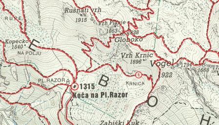
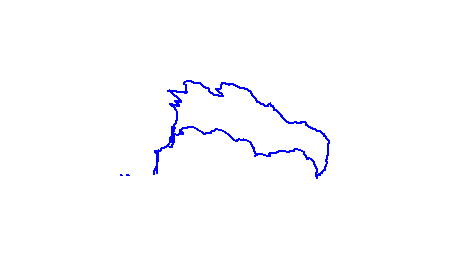
The map shows the path we took as recorded by the GPS receiver. Never trust a GPS track wholeheartedly; rely on your senses and maps.