Hiking in Slovenia » Gorenjska » Blegoš » Blegoš from Hotavlje
One of the longest ascents to Blegoš begins in Hotavlje, a village in the valley Poljanska dolina, best known for its quarry of high-quality Hotavlje stone. The route starts behind the quarry and takes you through sunny Čabrače, over steep haymeadows beneath Prva ravan and through beech forests below Blegoš. You can make a round trip by descending past Jelenci.
At a glance
- Difficulty
- Excellently waymarked quite steep path
- Access
- The route begins at Hotavlje, a village in the valley of Poljanska Sora, west of Škofja Loka.
- Distance
- Hotavlje–Blegoš: 3 hours
Blegoš – Koča na Blegošu – Jelenci – Hotavlje: 3 hours
Total: 6 - 7 hours - Altitude
- 1562 m
- Height difference
- 1100 m
- Season
- The trip can be made at any time of the year. In winter at least the upper part of the route will certainly be trodden through the snow.
- Recommended equipment
- Because of the length of this route, mountain boots and trekking sticks are almost obligatory.
- Map
- Škofjeloško in Cerkljansko hribovje, 1 : 50 000
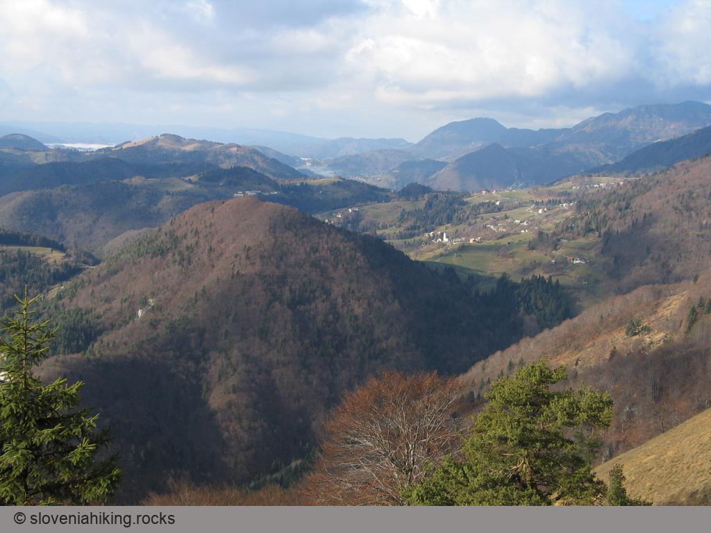
From Hotavlje to Čabrače
The hike begins in Hotavlje, a village in the valley Poljanska dolina between Trebija and Gorenja vas. When you turn off the main road Škofja Loka – Žiri, follow the signs for Blegoš or Marmor Hotavlje and at the fork in the village turn right. The road leads past the Marmor factory and the quarry, then beyond the quarry but before the next fork you'll see a large parking area where you can leave your car. At the fork waymarks direct you to the path which leads past the house at the fork up a steep slope above the righthand road.
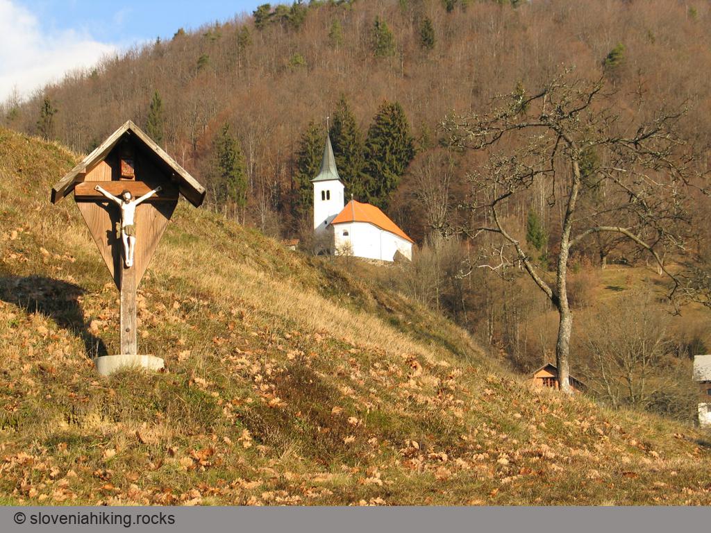
he path gradually rises through mixed forest, consisting mainly of beech and oak. Some minutes later you find yourself on a ridge from which here and there you can see on your left between the trees the slopes of Slajka. Here the path becomes gentler, and gradually changes into a cart-track, leading you onto meadows where the first proper views open up, though at first only of the surrounding hills (Slajka and Žirovski vrh). A bit further on a wayside cross greets you, past which you glimpse Čabrače, the first goal of this trip. The waymarks direct you to the left and then along a gentle cart-track onto the asphalt road that runs from the valley up to Čabrače. Turn right and you are soon faced by an interesting problem – the waymarks send you into a courtyard; you somehow sense it's necessary to climb up the steep meadow to the church, which you can see above you, but the way isn't actually obvious, and searching around other people's courtyards isn't too polite. You get out of this dilemma most easily by following the asphalt road through the village; in a few minutes this takes you to the church (sv. Jedrt – St. Gertrude's), which crowns the slope above Čabrače.
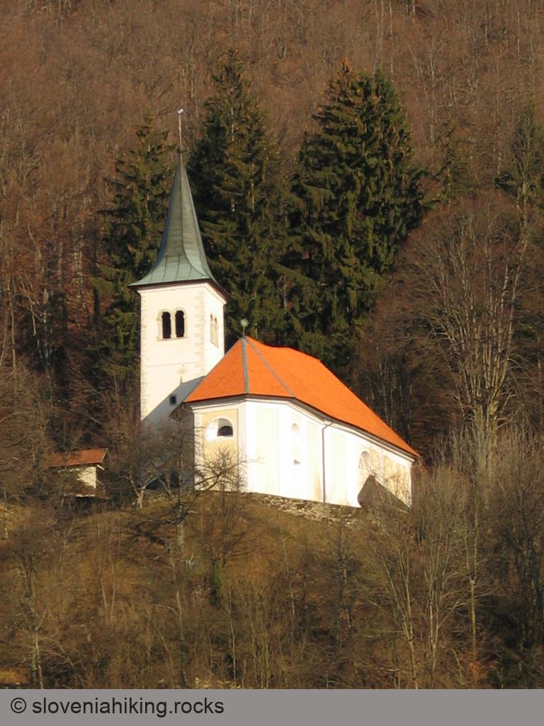
Before continuing the ascent, you should by all means take a look at the church you've just reached and also the view in front of it. A board on the church provides some details about its history (and the legend explaining why it was built so high above the village), while the interior has fine baroque altars (phone the priest's house in Gorenja vas before your visit).
The ascent to Prva ravan
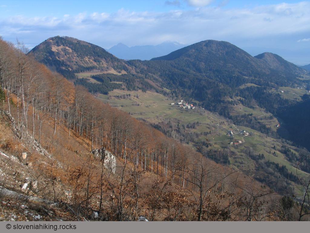
Continue your way to Blegoš along the asphalt road, which gradually ascends through the forest above Čabrače. This brings you in about 15 minutes to the Likar farm, where the view of the surrounding hills is revealed again. Since you have gained considerable height up to this point (you are now nearly 400 metres above Hotavlje), the view is also better; Ermanovec can now be seen behind Slajka, though the summit south of Likar still hides the view in that direction.
Beyond the farm you come to a cart-track fork. You won't see any signs or waymarks but perhaps footprints will help you, leading straight on along a little path which ascends steeply up the meadow beside the lefthand cart-track. You can, of course, go up this left cart-track, since at the top of the meadow you more or less find yourself on it, and on the edge of the meadow above it you'll see a waymark directing you slightly left onto a path that climbs through the forest.
Unlike most ascents in subalpine regions the climb up the slopes above the Likar farm is quite interesting, since the way mostly leads over meadows with fine views, interrupted only now and then by beech forest. Thus right after the first short ascent you come to a meadow where the path takes you straight up the steep slope to a bunker, on which such a big waymark is painted that you could almost see it even from Hotavlje. In front of this bunker there's a view of the Polhov Gradec hills and Žirovski vrh, and naturally it gets even better as you continue uphill – since you've reached an altitude of about 1000 metres, Slajka and Ermanovec are now considerably below you, Pasja ravan can be seen to the south, with Tošč and Grmada behind it, while westwards you can pick out Kojca and Porezen, and the plateau Šebreljska planota beyond.
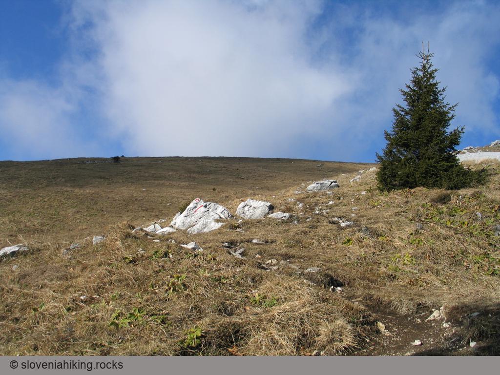
Beyond the bunker the path again turns into the forest; a short section along the ridge follows, which is considerably more gentle and allows a rest. The path runs by the bunkers of the Rupnik line, but when it leads you back onto the grassy slope, you're faced with the next climb. As before, here too you go straight up; the first ascent brings you to 1100 metres, after a short, easy section there's another 150 metres of steep slopes to gain in height, and then the worst labour is behind you – you've arrived at Prva ravan (1289 m) and less than 300 metres in height difference now separates you from the top of Blegoš.
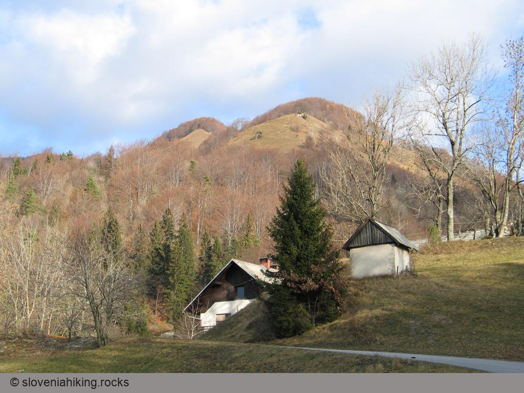
On Prva ravan you'll notice right beside the path one of the largest bunkers in these hills, beyond it the path begins to drop gradually and brings you to the memorial by the forest road coming from Črni Kal (on your right) past the foresters' hut, hidden among the trees just some hundred metres to your left. From this forest road a fine view appears above the tree-tops of the summits as far as Lubnik – an ideal spot for a short rest before the last part of the ascent.

The summit of Blegoš
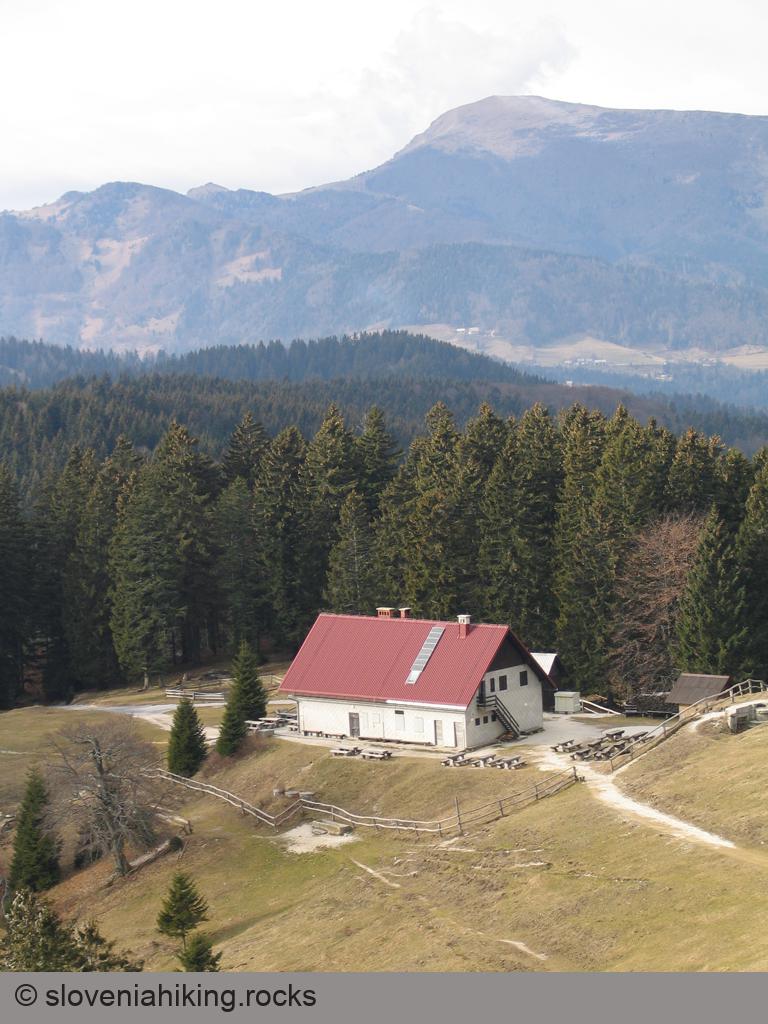
From Prva ravan you can reach the top of Blegoš by two paths – the one going direct to the summit takes a good half hour, but if you urgently need some refreshment before making the final climb, you'd better set off along the path below the slopes of Blegoš to the mountain hut Koča na Blegošu (before you leave on this trip check the PZS website to see if it's open). Both paths start above the road; the waymarks direct you onto a gentle path. At the beginning this leads through beech forest, but some metres further on this is replaced by spruces, among which the path divides – the right one heads for the summit, the left one for the hut.
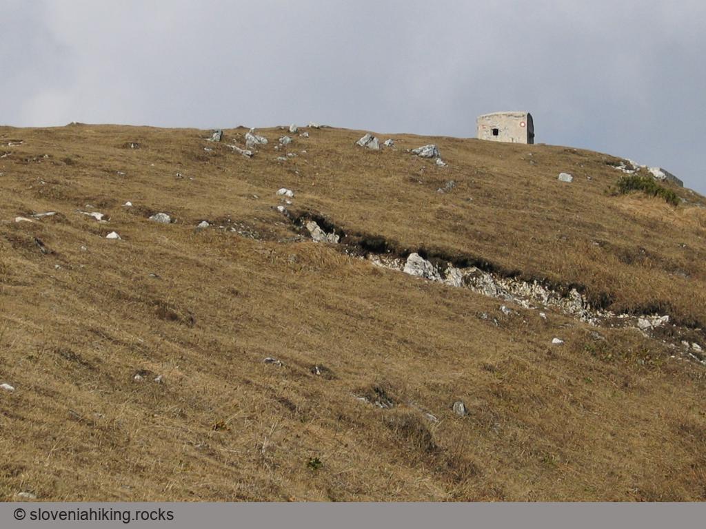
During the ascent you'll probably notice here and there between the trees the neighbouring summits, beyond which gleams the Karavanke range. After 20 minutes uphill, the path brings you to a gate in the fence surrounding the meadows on the top of Blegoš. Now there's only 100 metres of height difference left, but this will present you with an interesting optical illusion. As you climb up the steep grassy slopes, you notice a bunker above you which seems to be positioned just below the summit. It's not true … when you reach it, you catch sight of the next bunker, and only when you come to that one, the real summit appears to your left, but there a marvellous view awaits you, which in fine weather stretches from the Karavanke as far as Snežnik.
From the top of Blegoš you drop down along the western ridge by a clearly visible, broad but steep path to Koča na Blegošu, which stands in a pleasant sunny location on the edge of the forests below Blegoš.
The descent to Hotavlje
From the hut you can return to Hotavlje by the way you came (but of course you'd set off for Prva ravan by the direct path, not over the summit of Blegoš again), nevertheless a round trip via the small hut Zavetišče na Jelencih is certainly more interesting.
The route towards Jelenci at first goes along a forest road, which descends from Koča na Blegošu through the forest towards Črni Kal but at the first noticeable cross-roads turns left onto a broad path which soon brings you to Zavetišče na Jelencih. Continue descending past this hut along a cart-track which ends on the forest road you already know from Prva ravan.

The route for Hotavlje (though you'll more often notice signs for Volaka or Leskovica) crosses the forest road and begins to descend beside a pleasantly babbling stream. After 15 minutes turn left at a fork towards Volaka on a narrow little path, which almost disappears in the spruce forest. Fortunately the path (although obviously not used very much) is excellently waymarked so that it's almost impossible to lose it as long as you carefully follow the waymarks.
On this descent you again cross a cart-track and then the path ends at a surprisingly sturdy bridge, which is clearly a remainder from the building of the Rupnik line, since immediately beyond it a mule track begins which takes you gently down into Volaka. There the last riddle is waiting – you must decide which asphalt road leads to Hotavlje. A quick glance at the map shows that the stream must be on your right side, so you head along the lefthand road and after a good two kilometres of a rather boring walk on asphalt which, however, is enlivened by the constant accompaniment of the attractively babbling stream, you arrive back at the parking place where you left your car.
Map of the Route
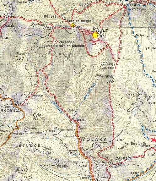
The map shows the path we took as recorded by the GPS receiver. Never trust a GPS track wholeheartedly; rely on your senses and maps.