Hiking in Slovenia » Primorska » St. Ivan and Šebrelje
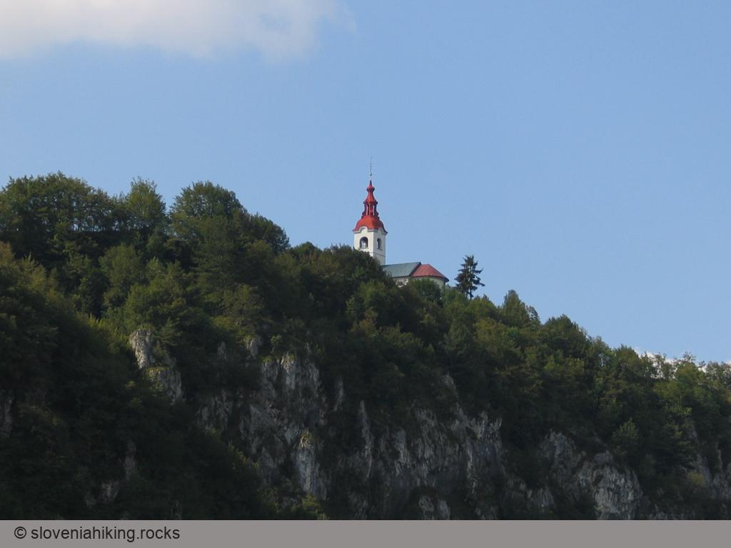
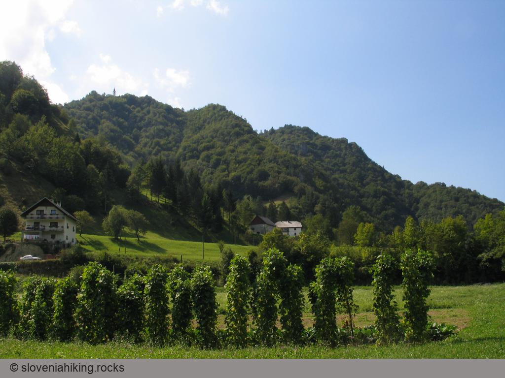
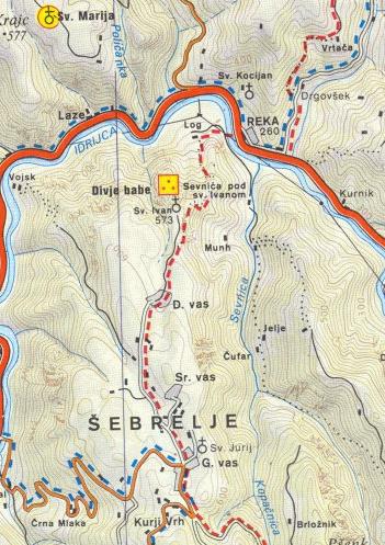
When you've been driving between Idrija or Cerkno and Tolmin, you've perhaps noticed St John's church (sv. Ivan) gleaming on top of the high steep faces above the Idrijca valley. Seeing it and the steep slopes and gullies that surround it on all sides, scarcely anyone can imagine that behind the church stretches the practically unknown sunny and hilly plateau Šebreljska planota. You can climb up to sv. Ivan by a waymarked path from Reka, via an old mule trail, or a steep and exposed path past Divje babe (now famous caves where even in prehistoric times they played on bone flutes), and after a short rest there, you can set off on a leisurely walk through this sunlit, hilly region.
At a glance
- Difficulty
- A waymarked, occasionally fairly steep path.
- Access
- The route begins in Reka, a hamlet on the road between Idrija and Tolmin
- Distance
- Reka–cerkev sv. Ivana (St John's church): 1 hour
Walk across Šebreljska planota: 1 hour
Descent to the valley: 45 minutes
Total: 3 hours - Altitude
- Sv. Ivan: 575 m
Gorenja vas v Šebreljah: 630 m - Height difference
- Reka – cerkev sv. Ivana: 340 m
Together with the walk around Šebrelje: 420 m - Season
- You can make this trip at all seasons of the year, I would only advise against it after heavy rain or in mid-winter (the icy rocks below Šebreljska planota can be dangerous). Of course you'll enjoy the view of the Cerkljansko hills and the Lower Bohinj mountains only in clear, fine weather.
- Recommended equipment
- The path is steep in some places – good footwear and trekking sticks are appropriate. In the lower part the path is overgrown, so in summer insect repellent is virtually obligatory.
- Revision history
- The original Slovenian text (written in 2004) was translated into English by Margaret Davis. I added short notes after visiting Šebrelje in March 2021. The poetic language is hers, the errors are mine.
- Map
- Škofjeloško in Cerkljansko hribovje, 1 : 50 000
- Coordinates
-
Start: 46.117423, 13.921578
Peak: 46.110149, 13.917076
From Reka to sv. Ivan
The route to Šebrelje begins in Reka, a hamlet on the road between Idrija and Tolmin. In Reka, cross the bridge across Idrijca, and park at a tiny parking lot next to the bridge.
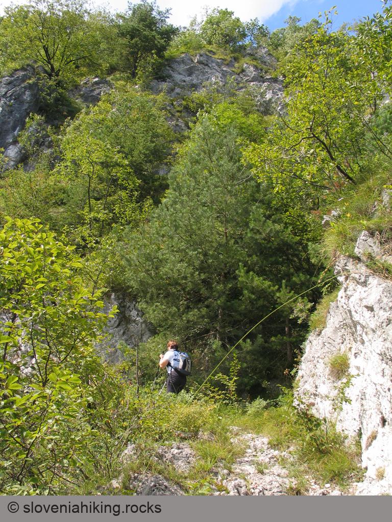
The asphalt road winds by the edge of a meadow. Take a left on the first fork, and then a sharp right following waymarks and red arrows. Continue as far as the last house, where with some luck you'll see a waymark placed high up on the meadow behind the house. Go left across the yard, and then straight up along the remnants of an old cart-track. This bears slightly right and then completely disappears, leaving you with only a narrow, but fairly well-used little path, which climbs steeply into the forest. At first it simply heads straight up the slope, but when this becomes too steep, it changes to short zig-zags, bringing you after about half an hour's ascent to a ridge from which you can already see between the trees the neighbouring summits of the Idrijsko hills.
On the ridge the path merges with a recently-cleared mule track, turns right, and follows it comfortably to a rocky edge, above which you'll probably observe the gleaming walls of sv. Ivan. The path now turns left before the rocks and takes you into increasingly precipitous terrain, but then manages to find a natural passage through the rocks, twisting right and again left, and guides you without difficulty along fairly broad ledges above the rocks (while walking along these rock ledges watch out for snakes).
From the ledges the path turns again into the forest, which brings to an end the view of the Sevnica ravine and surrounding summits, and some minutes later you find yourself on a broad cart-track leading over surprisingly gentle meadows. Turn right and in a few minutes you see the beautifully restored church of sv Ivan in front of you.
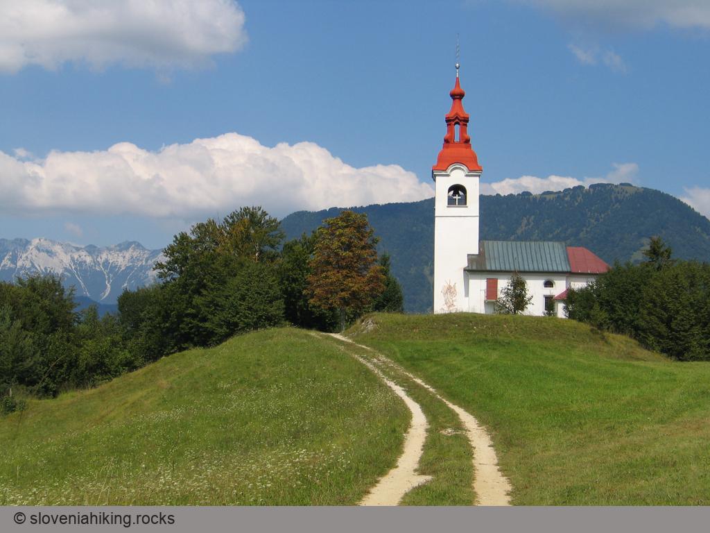
After a short rest in the shade of the trees growing around the church and before continuing your trip, you must by all means walk to the northern defence wall and climb up onto it – you'll be rewarded with an excellent view of part of the Lower Bohinj mountains appearing above the ravine Bukovska grapa through a gap between the plateau Šentviška planota and the summit of Kojca; you'll soon pick out Porezen in Bukov vrh as well, while far behind them, on a clear day, the typical bald top of Blegoš is there to greet you.
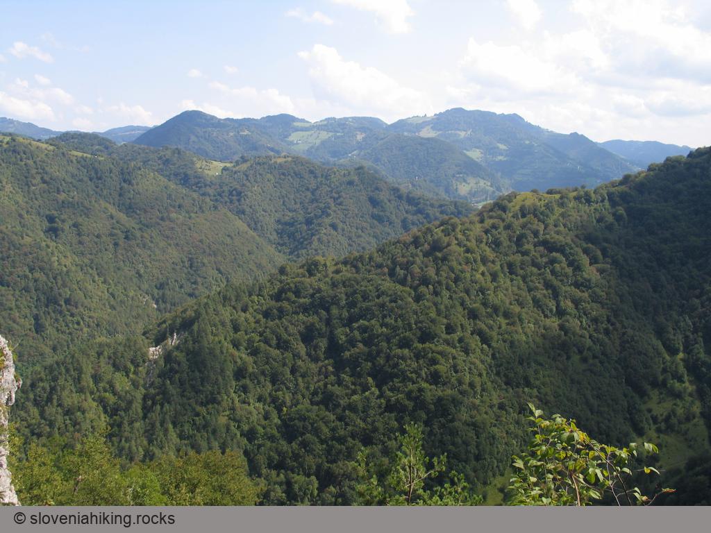
From the church you can set off on a walk around Šebreljska planota (I recommend it!), or drop down to the caves Divje babe (the well-marked path begins right by the church) and then try to find the little path that leads into the valley, but if you're short of time, it's best to return to the valley the same way as you came.
Alternate ascent via a mule track
The waymarked path to Šebrelje follows the shortest footpath used in the old days when people still walked to the valley to go to work. Still, when they had to transport goods to Šebrelje, they used a mule track that has been totally neglected once a road from Stopnik was built. That mule track has been cleared a few years ago and provides a pleasant alternative:
- From the parking lot, follow signs for “Mulatiera” (mule track)
- When the red arrows send you right, turn left onto a gravel road. After ~100 meters, you’ll see the next signpost sending you right onto the mule track
- In 30 minutes, the mule track merges with the marked footpath (see above).
Descent via Divje Babe
Instead of walking around Šebrelje plateau, you could decide to visit Divje Babe. A well-protected path starts next to the church and safely brings you to the cave (you need a guide to visit it).
The direct return to the Idrijca Valley is not for the faint-hearted. A narrow footpath crosses a steep slope, and while you’ll notice an old rusted steel cable nearby, it probably won’t give you more than moral support.
Fortunately, the footpath quickly expands into a steep dirt trail that will bring you back to the start of the waymarked path.
A circular route around Šebreljska planota
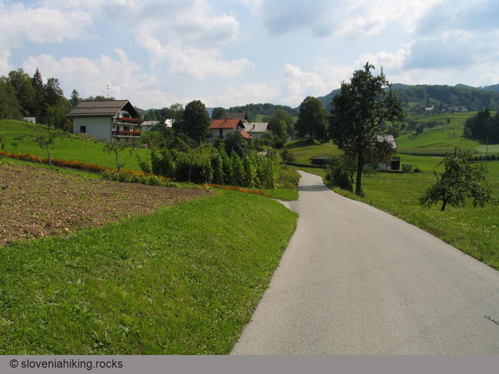
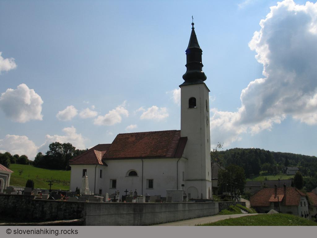
It's certainly sensible to continue your ascent to the margin of Šebreljska planota with a leisurely walk around this hilly and sunny plateau. The cart-track leads you from sv. Ivan to the village of Dolenja vas, where it changes into a narrow asphalt road (now and then we mountaineers must pay the price of progress), which after a short ascent past Kovk, which rises on the left, leads to the meadows and fields around beautifully arranged Gorenja vas. Before the cross-roads where the road from Stopnik enters the village, turn left uphill between the old houses tightly squeezed together to the church of sv. Jurij (St. George) and then continue left by the church and slowly start to return towards Srednja vas.
Behind the first houses the asphalt road changes to a cart-track that takes you straight ahead but just before the next stretch of asphalt begins you turn up to the right along a rather indistinct cart-track. This soon changes into a well-trodden little path leading behind the houses towards Kovk (where you'll quickly notice an enclosure used for breeding deer). When the path reaches the meadow below the enclosure it disappears; look for its continuation on the edge of the forest straight across the meadow.
After a short walk through the forest you find yourself in the next meadow, where the path changes into a cart-track beside a log cabin and brings you to the houses in Dolenja vas. From there return by the cart-track to sv. Ivan and then descend to the valley by the waymarked path or the route past Divje babe.
The descent into the Sevnica valley
Those who like finding almost forgotten and abandoned little paths will certainly enjoy the descent by the old path into the Sevnica valley, which the local people used whenever the route via sv. Ivan was too hot. The path is very accurately shown on the Geodetska uprava 1:25 000 map so that lucky owners of a GPS receiver will easily find it, but others with keen eyes and a little orienteering ability won't have any difficulties.
The route begins where the path past Srednja vas towards Dolenja vas loses itself in the meadow. Instead of searching for its continuation straight ahead on the far side of the meadow, turn down some thirty metres or so over the slope and look for a path that from the edge of the forest gradually drops down towards the north (to the left). A short descent is followed by some rock steps that enable you to overcome a short rock wall. Soon after that you'll notice a fork: the righthand path leads towards the Čufar farm, but you turn left and in a few minutes come to interesting rock overhangs (according to the locals' accounts, chasms in these rocks are linked with Divje babe, while an attentive ear will also catch the sound of subterranean waters).
From here the path still leads you leftwards, reaching a small grassy ridge. With a few strides along the ridge you can detour to a viewing point from which you'll admire the cliffs below sv. Ivan, then return to the path and continue to drop down along the gully/ravine. At the start of the gully the path virtually disappears by a rockfall; look for its continuation lower down in the forest, and then a definite little path leads all the way to the meadows above Munh (a farm immediately above the Sevnica river). At the beginning of the meadows the path is sliced by scree; skirt this along its upper edge, and then try to follow the path through the tall grass that covers the abandoned meadows above the farm.
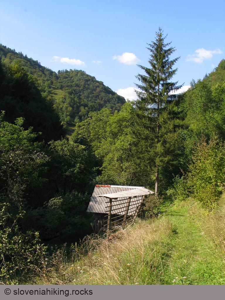
When you reach the farm, you'll soon notice an old broad cart-track which goes to the right into the valley. This quickly narrows to a path that takes you to a stream. Cross this by the stones (probably there is a bridge but I didn't find it), and then head uphill by an old hay-hut to a cart-track that soon drops down to the next farm (Munhajše). There a macadam road begins which leads you beside the stream to the turning by the hay-hut where you started the ascent to Šebrelje. Only some minutes' walk now remains back to the carpark.
Map of the Route
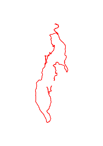
The map shows the path we took as recorded by the GPS receiver. Never trust a GPS track wholeheartedly; rely on your senses and maps.