Hiking in Slovenia » Vipava Valley » Škavnica
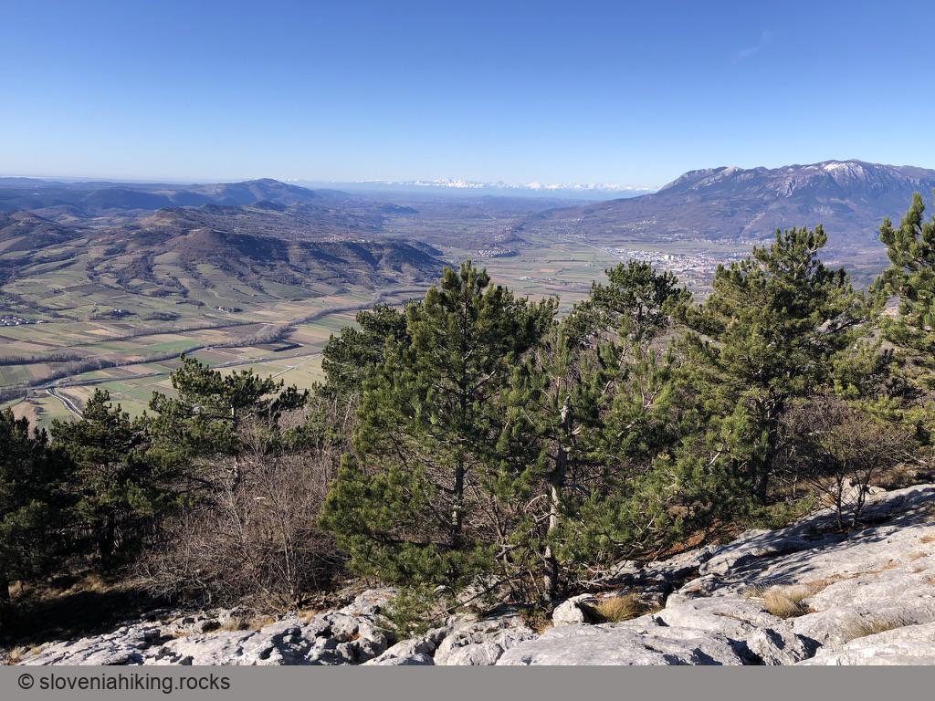
Škavnica is a giant limestone slab in the middle of a pine forest on the west slopes of Nanos plateau. I usually hike there to admire its limestone pavement crisscrossed with deep fissures; the view of Vipava valley, Adriatic sea, and the Italian Alps is just the icing on the cake.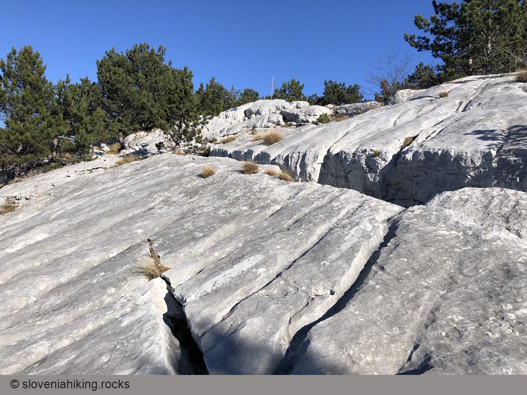
At a Glance
- Difficulty
- Easy hike with a few steeper sections
- Altitude
- 734 m
- Average time
-
Ascent: 1 hour 30 minutes
Descent: 1 hour
Total: 3 hours
- Elevation gain
- 490 m
- Coordinates
-
Start: 45.832270,13.971014
Peak: 45.84970,13.98185
Getting There
- Hike to Plaz. Take a break and enjoy the view.
- Follow the waymarks onto a narrow footpath going west from the picnic tables north of the vista point.
- The footpath slowly turns into a rocky trail – an old dirt road from Vipava valley toward Nanos. Keep to the right following signs for Škavnica.
- Another sign for Škavnica (or Nanos/Abram) will send you right onto a steeper shortcut.
- A bit after the point where your path merges with the original trail (which took a wide detour), you’ll notice another sign for Škavnica sending you left onto a narrow muddy1 footpath.
- In ~15 minutes2, the easy-to-follow well-marked footpath reaches a rocky barrier. A bit further on, you’ll notice an easy ledge that will bring you to the top of the slab.
-
At least it was muddy every single time I was there. Admittedly I’m hiking around those hills in autumn/winter and not during summer drought. ↩︎
-
Vipava valley must have a large population of endurance runners – most of the durations I’ve encountered were a bit overly optimistic. Expect to hike a bit longer than that. ↩︎
Map of the Route
The map shows the path we took as recorded by the GPS receiver. Never trust a GPS track wholeheartedly; rely on your senses and maps.